TAS LAB Trustworthy Autonomous Systems Laboratory

Projects

2024

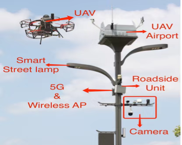
Reliable UAV Perception and Perching Solutions in Urban Streets

Develop a comprehensive UAV perception and Perching solution, focusing on the integration of smart streetlight poles with a UAV takeoff, landing, and battery exchange platform
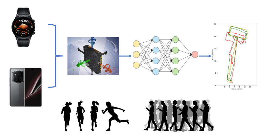
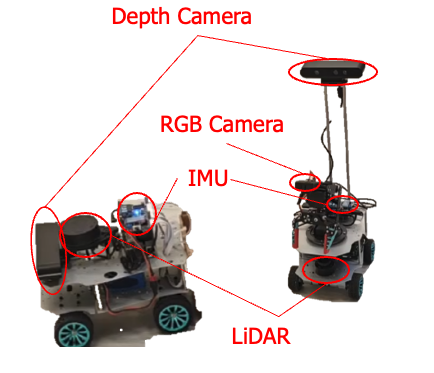
AI assisted inertial navigation system

Introduction Inertial odometry is a critical technology used in various applications, from robotics and autonomous vehicles to augmented reality (AR) and wearable devices. It involves estimating the position and orientation of an object over time using data from inertial measurement units (IMUs), which typically include accelerometers and gyroscopes. However, traditional inertial odometry systems often face challenges such as sensor noise, bias, and drift, which can lead to cumulative errors and reduced accuracy over time. To address these challenges, AI-aided inertial odometry has emerged as a promising solution, leveraging the power of artificial intelligence to enhance the performance and reliability of inertial navigation systems. By integrating AI techniques such as machine learning and sensor fusion, these systems can intelligently process and interpret IMU data, correcting for errors and improving overall accuracy. AI-aided inertial odometry systems can learn from patterns in sensor data, adapt to different environments, and integrate information from multiple sources, such as cameras and GPS, to provide more robust and precise motion tracking. This advancement not only mitigates the limitations of traditional inertial systems but also opens up new possibilities for applications in complex and dynamic environments where traditional methods may fall short. As AI continues to evolve, its integration with inertial odometry is expected to drive significant innovations across various fields, enhancing the capabilities of autonomous systems and enriching user experiences in wearable devices. This project aims to develop a deep learning-based inertial navigation algorithm that utilizes accelerometer, gyroscope, and magnetometer data from smart wearables and smartphones to infer the user’s position and movement trajectory, while providing corresponding confidence levels.

Development of an Assisted Navigation and Collision Avoidance System using AI and Location-based Service

Transport Department

Safe-assured Learning-based Deep SE(3) Motion Joint Planning and Control for Unmanned Aerial Vehicles

PolyU (UGC)

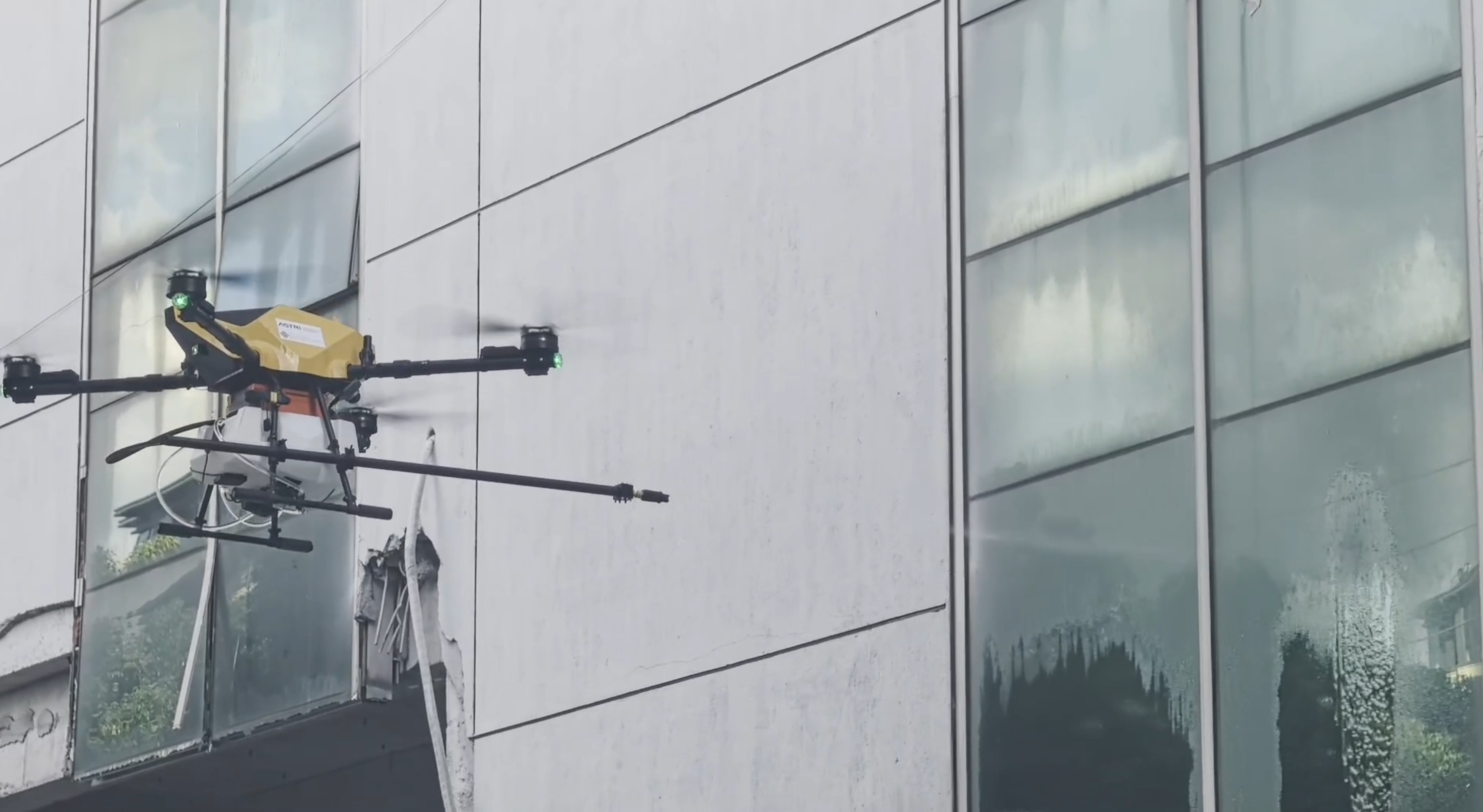
Sustainable Window Cleaning for PolyU Jockey Club Innovation Tower with Unmanned Aerial Vehicles UAV :An Application of Autonomous Systems Enabled Carbon Reduction
Sustainable Window Cleaning for PolyU Jockey Club Innovation Tower with Unmanned Aerial Vehicles (UAV):An Application of Autonomous Systems Enabled Carbon Reduction

PolyU (UGC)

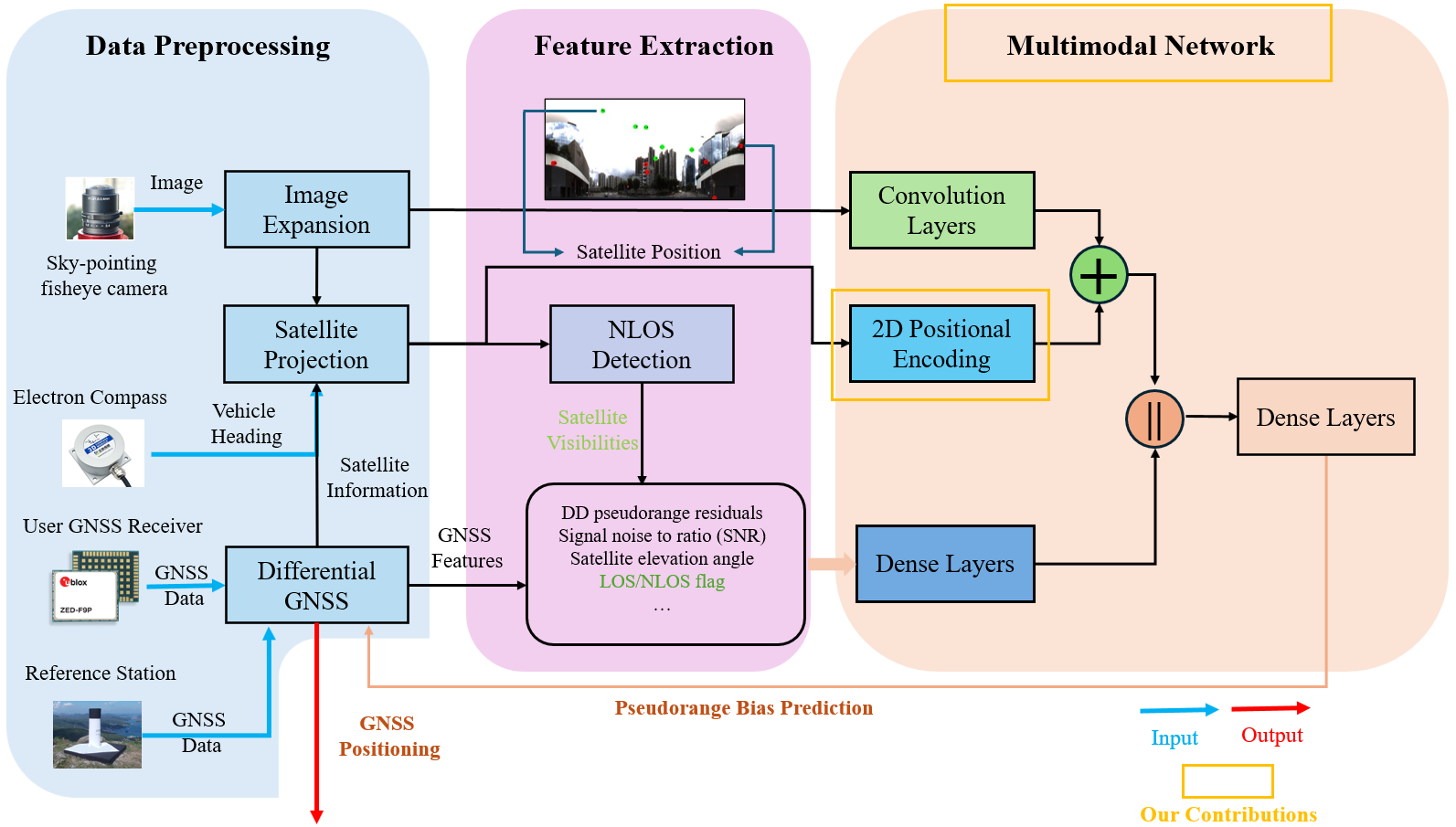
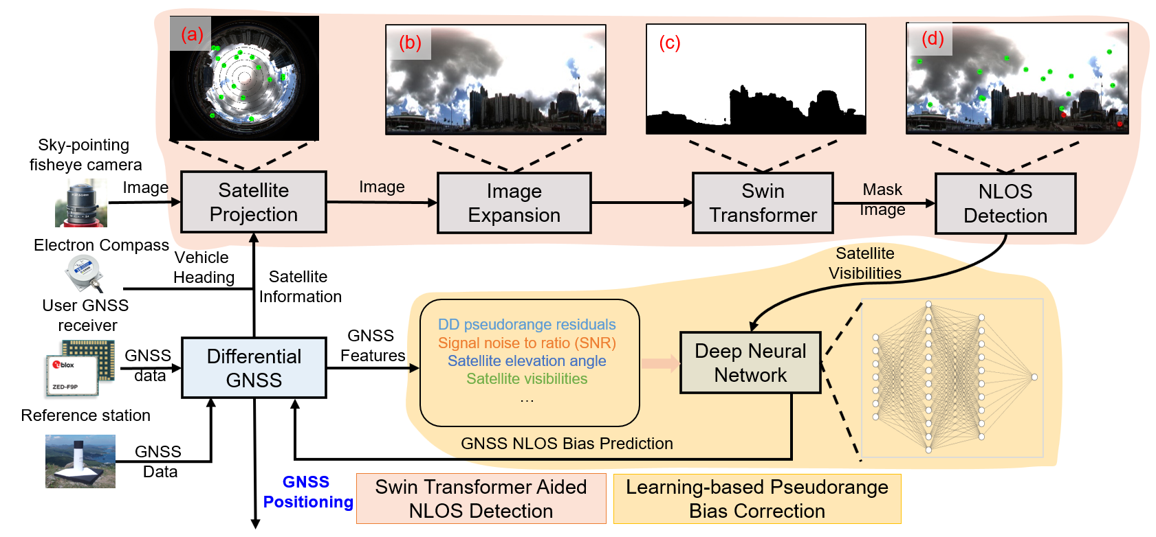
Data-driven-assisted GNSS RTK/INS Navigation for Autonomous Systems in Urban Canyons

PolyU (UGC)

Maximum Consensus Integration of GNSS and LiDAR for Urban Navigation

PolyU (UGC)

2023

Multi-robot Collaborative Operations in Lunar Areas for Regolith Processing

RCDSE, PolyU

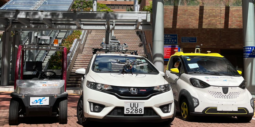
Vehicle-infrastructure Collaboration for Connected Unmanned Ground and Aerial Vehicles in Complex Urban Canyons

PolyU (UGC)

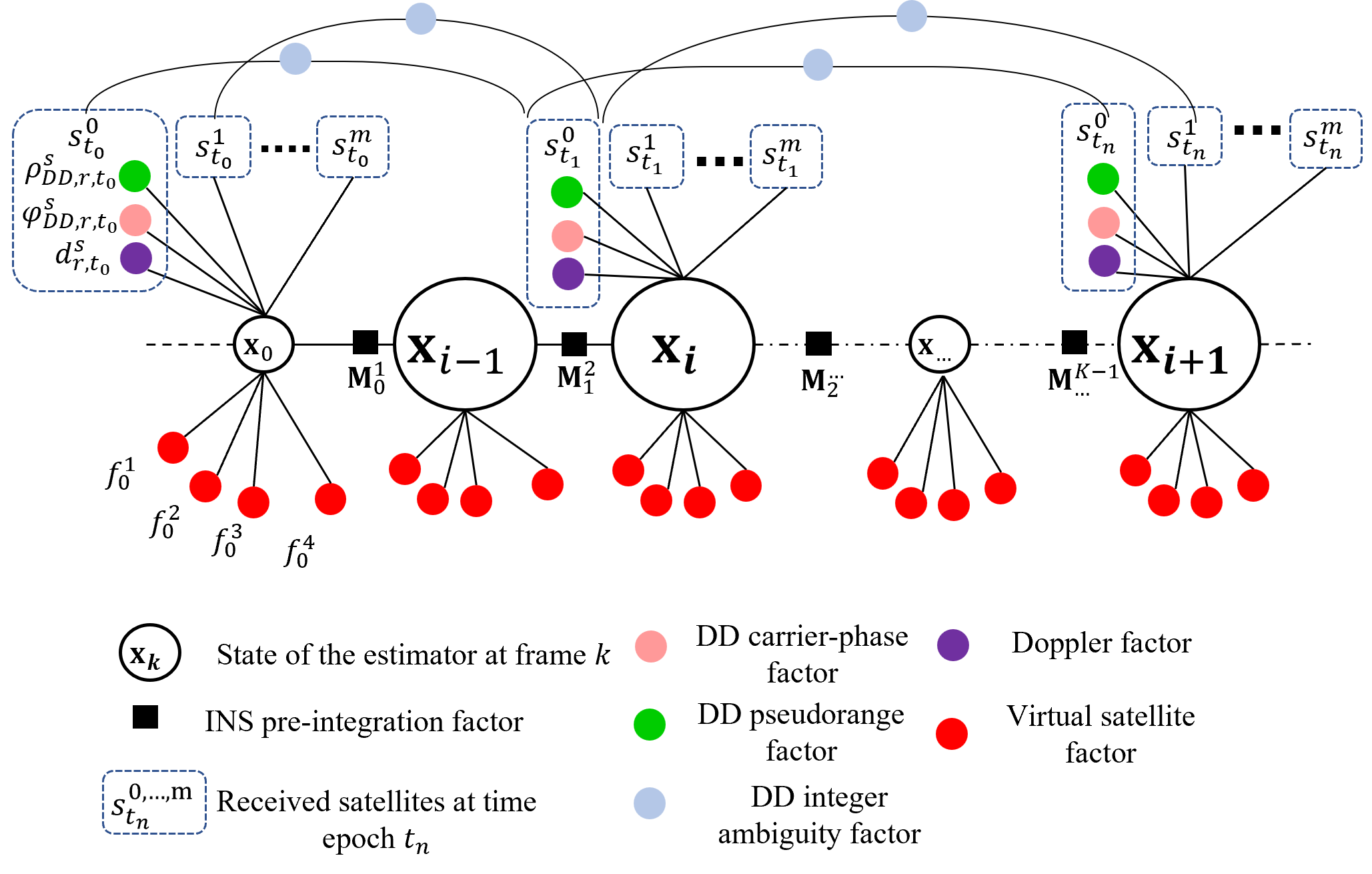
Research on high-precision vehicle-mounted GNSS/IMU/Camera fusion positioning technology in complex urban environments based on factor graph

Tencent Dadi Tongtu (Beijing) Technology Co., Ltd 騰訊大地通途北京科技有限公司

Unmanned Aerial Vehicle Aided High Accuracy Addictive Manufacturing for Carbon Fiber Reinforced Thermoplastic Composites MaterialCanyons

RIAM, PolyU

Vision Aided GNSS-RTK Positioning for UAV System in Urban Canyons

Meituan (Collaborative)/深圳市美團機器人研究院

Safety-certifiable UAV System for Terrian and Civil Infrastructure Inspection

PolyU (UGC)

2022

Research on GNSS Urban Positioning Algorithm Based on 3D LiDAR

Department of Science and Technology of Guangdong Province (GDSTC) 廣東省科學技術廳

2021

Huawei-PolyU High-accuracy Localization Project second phase
Huawei-PolyU High-accuracy Localization Project (second phase)

Abstract