GLIO: Tightly-Coupled GNSS/LiDAR/IMU Integration for Continuous and Drift-Free State Estimation of Intelligent Vehicles in Urban Areas
Abstract
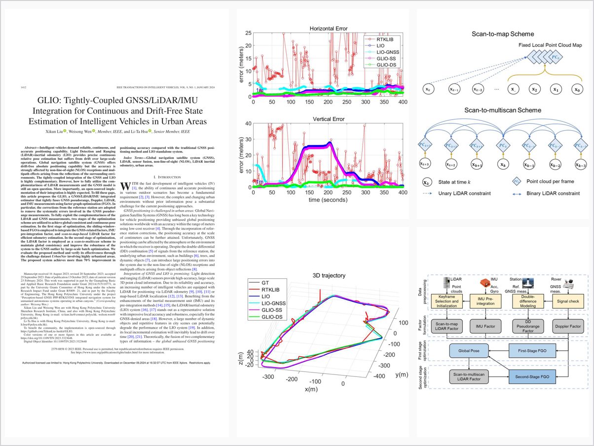
Intelligent vehicles demand reliable, continuous, and accurate positioning capability. Light Detection and Ranging (LiDAR)-inertial odometry (LIO) provides precise continuous relative pose estimation but suffers from drift over large-scale operations. Global navigation satellite system (GNSS) offers drift-free absolute positioning capability but the accuracy is strongly affected by non-line-of-sight (NLOS) receptions and multipath effects arising from the reflections of the surrounding environments. The tightly-coupled integration of the GNSS and LIO is highly complementary. However, how to fully utilize the complementariness of LiDAR measurements and the GNSS model is still an open question. More importantly, an open-sourced implementation of their integration is highly expected. To fill these gaps, this article proposes the GLIO, a GNSS/LiDAR/IMU integrated estimator that tightly fuses GNSS pseudorange, Doppler, LiDAR, and IMU measurements using factor graph optimization (FGO). In particular, the corrections from the reference station are adopted to remove the systematic errors involved in the GNSS pseudorange measurements. To fully exploit the complementariness of the LiDAR and GNSS measurements, two stages of the optimization scheme are utilized to achieve global consistent and continuous pose estimation. In the first stage of optimization, the sliding-window-based FGO is employed to integrate the GNSS-related factors, IMU pre-integration factor, and scan-to-map-based LiDAR factor for efficient odometry estimation. In the second stage of optimization, the LiDAR factor is employed as a scan-to-multiscan scheme to maintain global consistency and improve the robustness of the system to the GNSS outlier by large-scale batch optimization. We evaluate the proposed method and verify its effectiveness through the challenge dataset UrbanNav involving highly urbanized areas. The proposed system achieves more than 70% improvement in positioning accuracy compared with the traditional GNSS positioning method and LIO standalone system.
Problem Addressed
LiDAR-inertial odometry drifts over large-scale operations while GNSS absolute positioning suffers from NLOS receptions and multipath in urban areas; fully exploiting their complementarity, together with an open-sourced implementation, remains an open problem.
Key Contributions
- GLIO estimator tightly fusing raw GNSS pseudorange, Doppler, LiDAR, and IMU measurements via factor graph optimization
- Reference-station corrections removing systematic errors from GNSS pseudorange measurements
- Two-stage optimization combining sliding-window FGO odometry with batch fusion for global consistency
- Scan-to-map and scan-to-multiscan LiDAR factors improving robustness to GNSS outliers
- Evaluated on the challenging UrbanNav dataset in highly urbanized areas
Conclusions
Experiments on challenging sequences collected in Hong Kong demonstrate reliable accuracy and robustness in urban environments using commercial-level GNSS receivers with a LiDAR/IMU sensor kit, achieving more than 70% improvement. The system still shows a maximum error of nearly 10 meters where unhealthy GNSS observations are not fully mitigated.