Research direction

Embodied Drones for City Maintenance

Intelligent drones that inspect, clean and maintain the city

The Hong Kong Polytechnic University Department of Aeronautical and Aviation Engineering
← All research directions

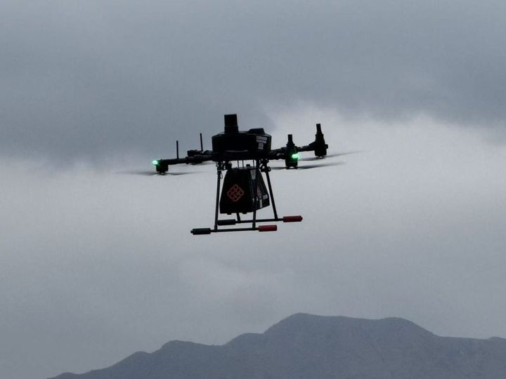
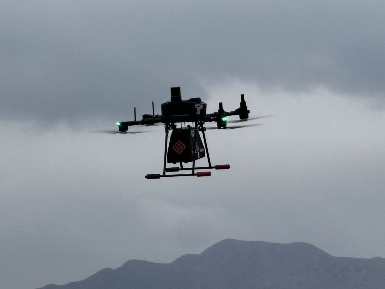
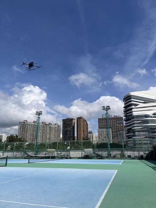
Maintaining a dense city — cleaning the façades of high-rise buildings, inspecting slopes, bridges and structures in urban canyons — is slow, costly and dangerous work at height. We develop embodied drone platforms that combine reliable navigation in GNSS-degraded streets with contact-aware aerial manipulation for real maintenance tasks.

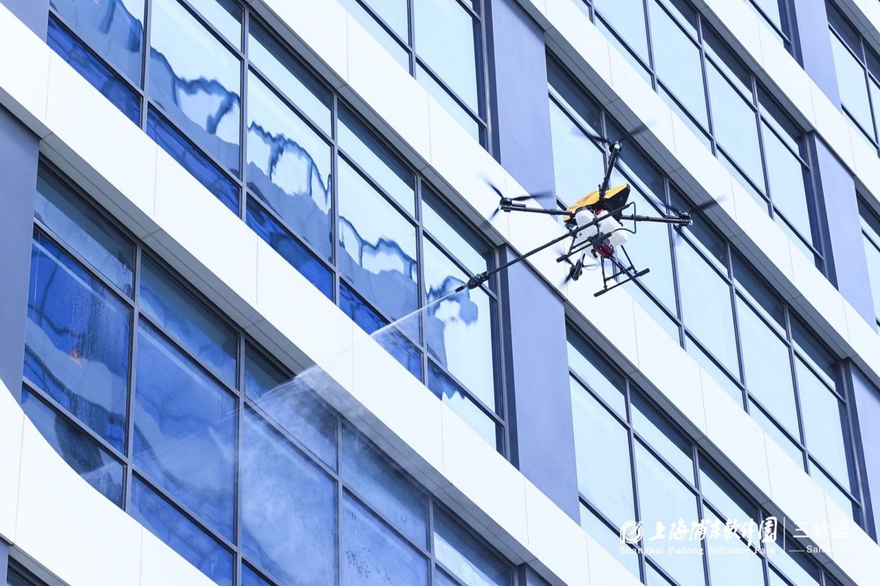
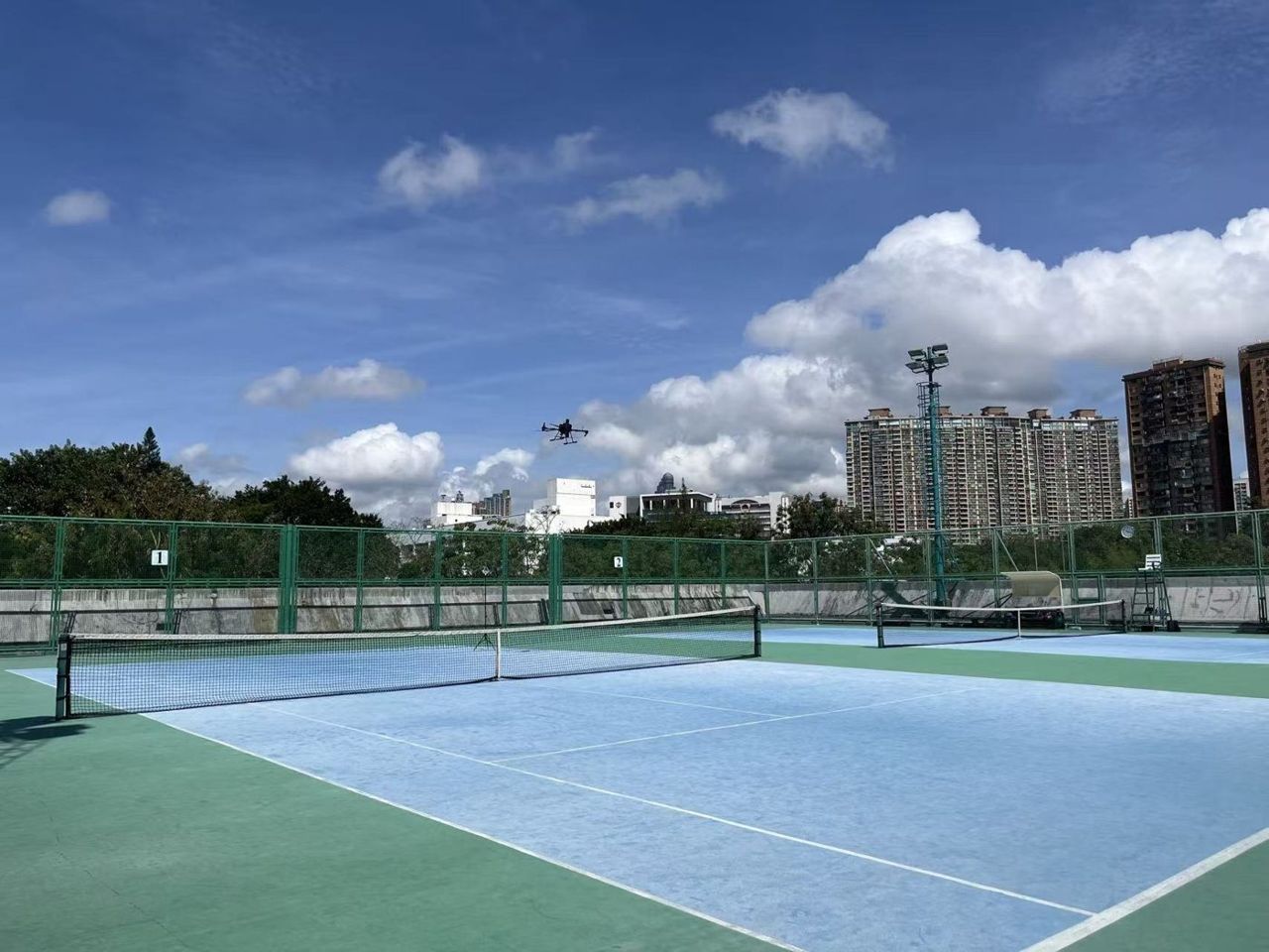
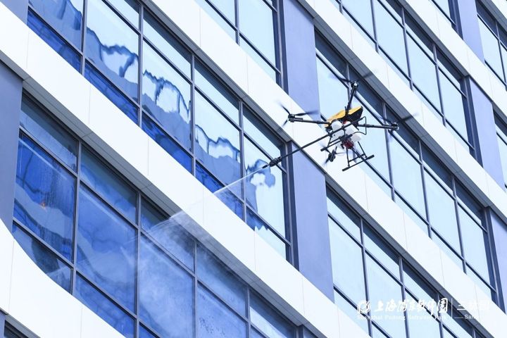
Our drones have cleaned glass façades in Hong Kong and Shanghai, inspected slopes and offshore wind turbines, and grown into the CeresRobotics.ai spin-off.

  • Urban-canyon navigation
  • Close-proximity flight
  • Aerial manipulation
  • UAV swarms
  • 3D reconstruction
  • VLA mission planning
  • Edge AI
Embodied drones for city maintenance and manipulation

Our Approach

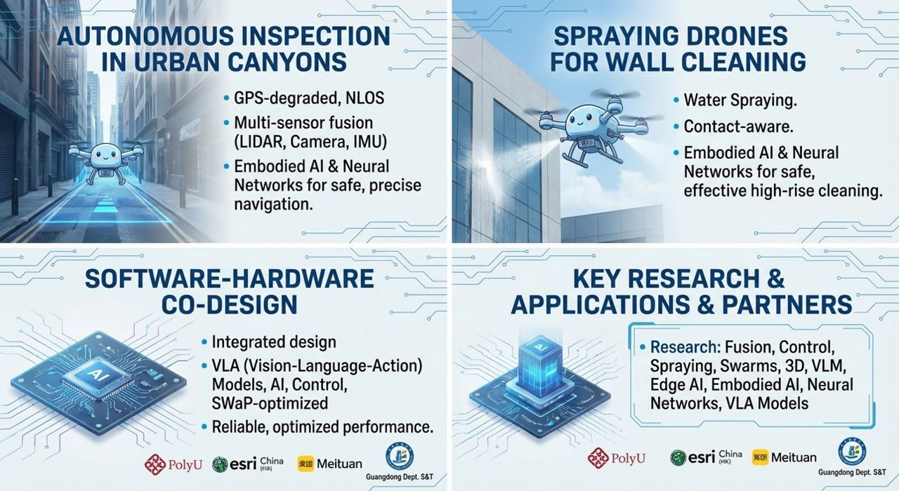
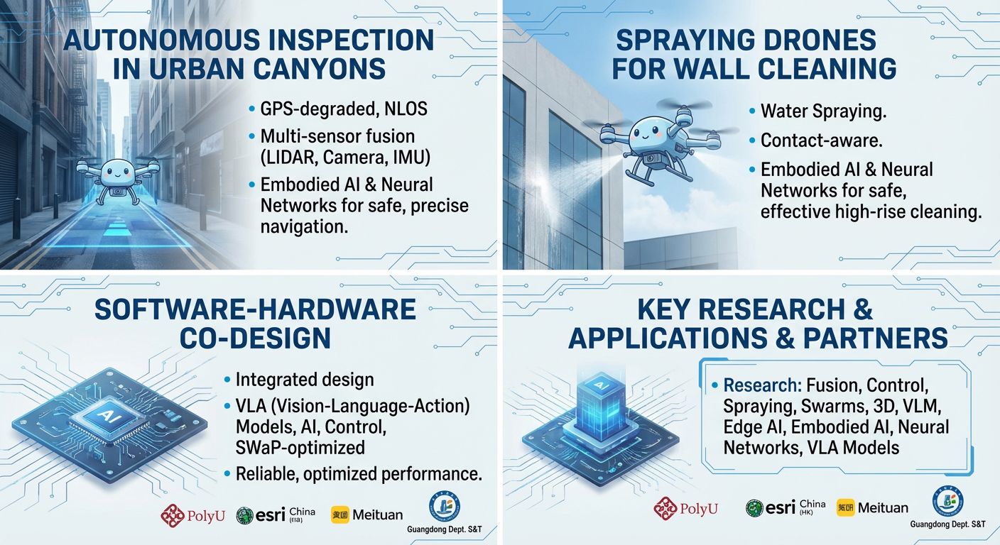
  1. Autonomous inspection in urban canyons

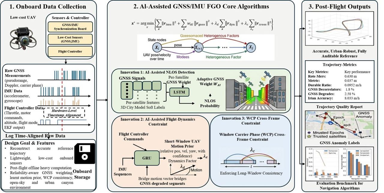
    AI-driven LiDAR/camera/IMU/GNSS fusion gives centimetre-level positioning for close-proximity inspection of façades, bridges and other structures.

  2. External wall cleaning with drones

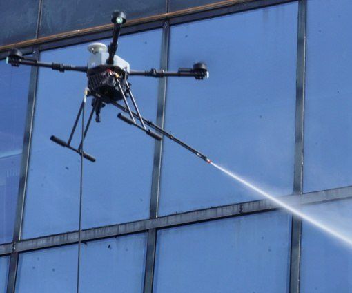
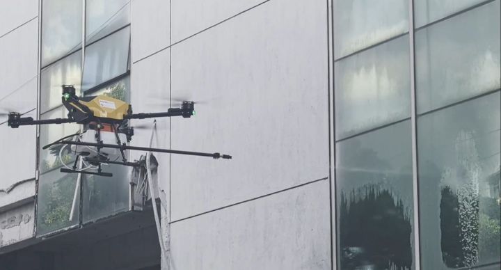
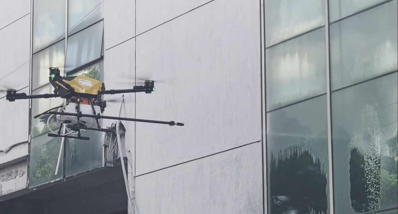
    Aerial manipulation with contact-aware flight control lets drones approach a wall, keep stable contact and clean despite wind and varying surfaces.

  3. Software-hardware co-design

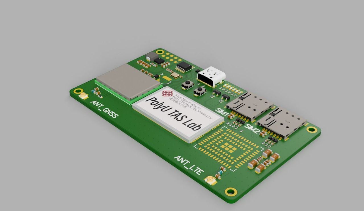
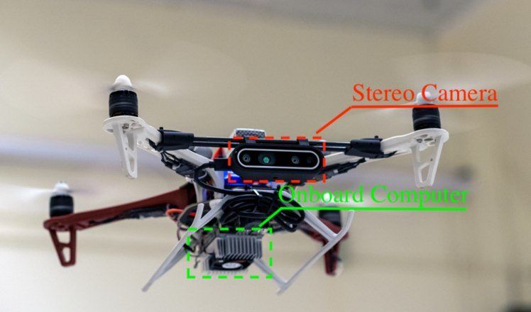
    Perception, planning and contact control are designed together with the airframe, end-effectors and onboard computer to meet tight size, weight and power limits.

Target applications

Research in Action

Systems we have built and tested with partners. Open a card for the problem, our approach, results and photos.

Autonomous Façade-Cleaning Drones

Autonomous Façade-Cleaning Drones

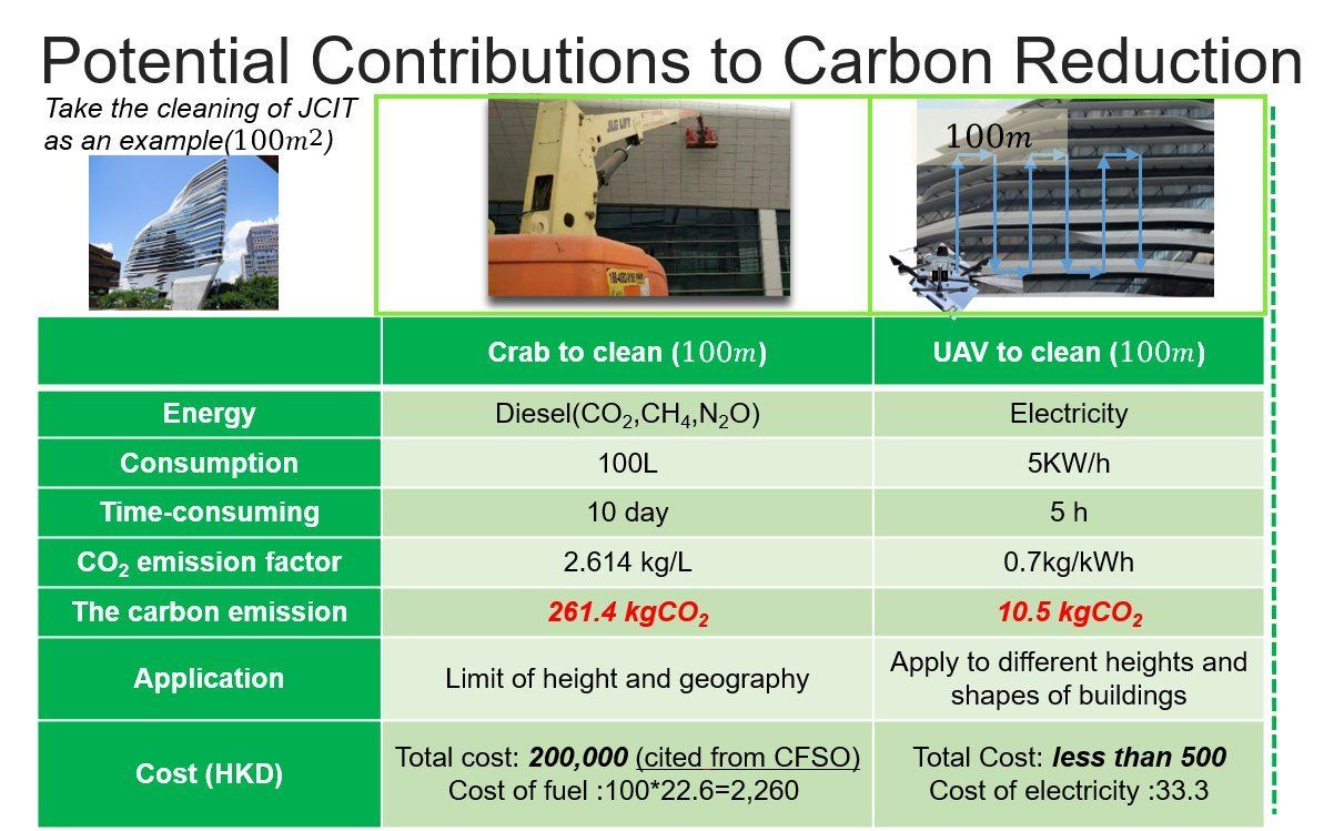
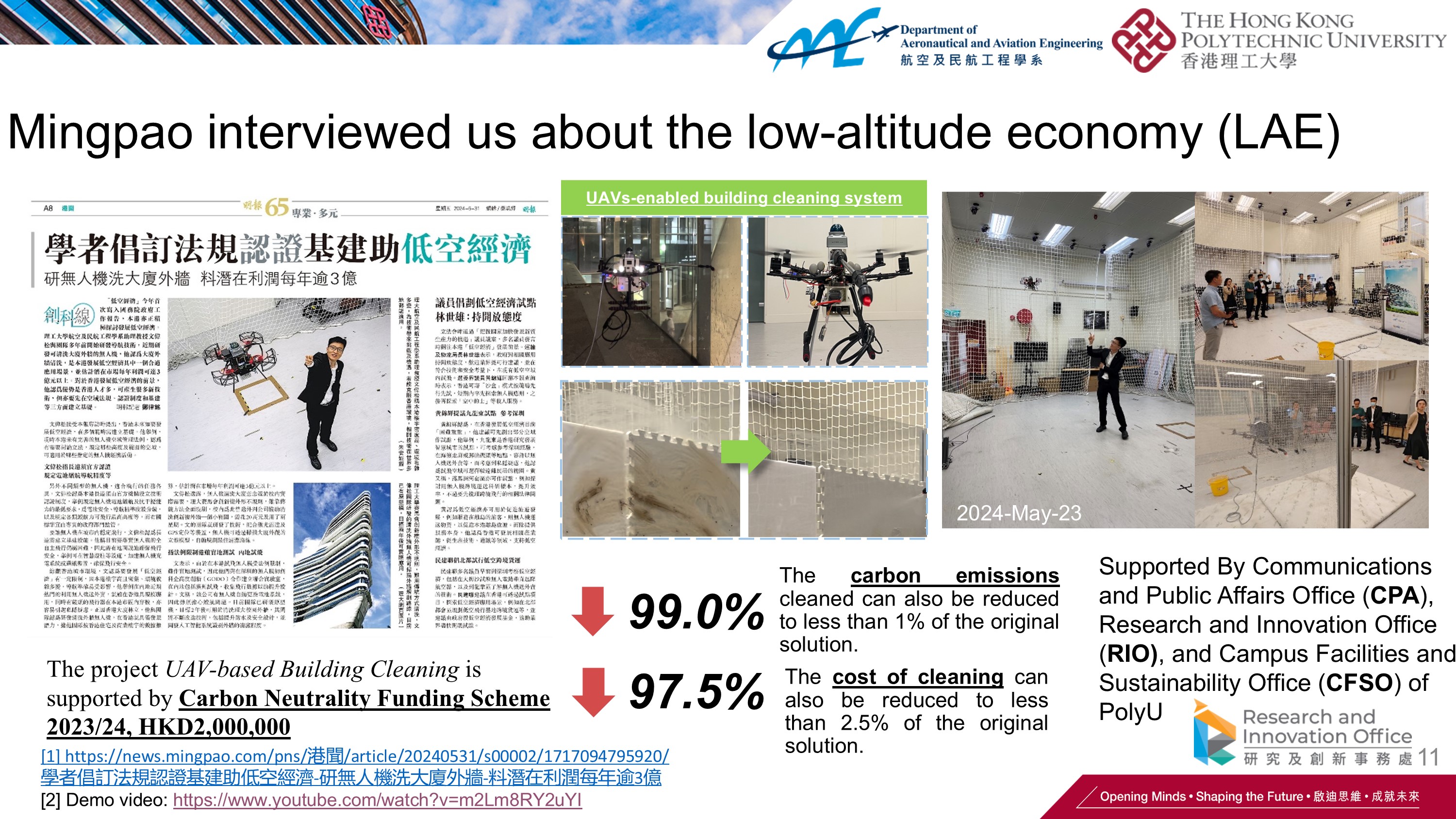
Drones that clean glass façades autonomously, cutting carbon emissions and work at height — now a spin-off company (CeresRobotics.ai) and a Geneva silver medal.

  • 277.8 → 2.91 kg CO₂ per cleaning
  • PCT · US · CN patent filings
  • Silver Geneva Inventions 2025
Problem, approach & results

ProblemCleaning an irregular high-rise glass façade by hand takes about two weeks each time, with workers at height.

Approach
  • Safety-assured UAV positioning, perception and control near glass façades
  • Purpose-built cleaning drone designed with the PolyU Campus Facilities team
  • Spun out as the CeresRobotics.ai start-up for building-exterior cleaning

ResultsSilver medal at the International Exhibition of Inventions of Geneva 2025; PCT, US and CN patent filings; covered by TVB and Ming Pao (May 2024) and UBeat (Nov 2025); student Innovation & Entrepreneurship Third Prize (2024).
Window-Cleaning Drone Positioning and Control

Window-Cleaning Drone Positioning and Control

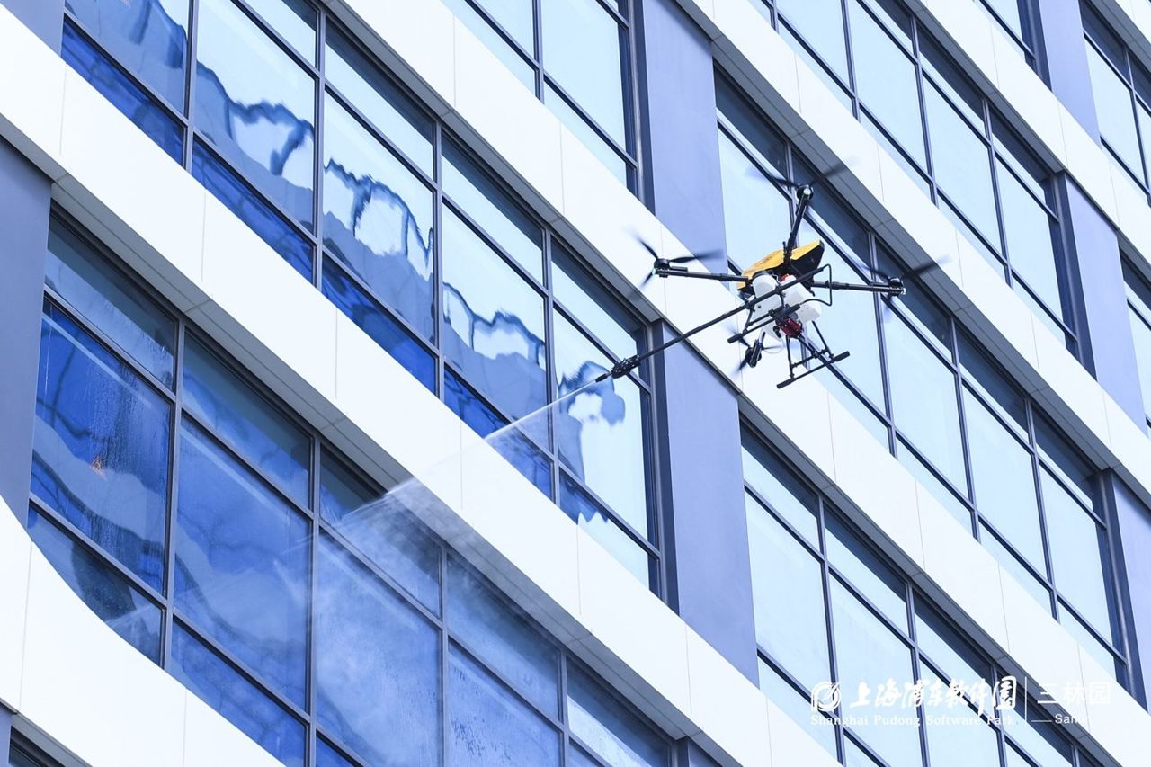
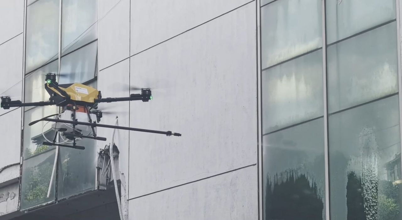
IMU–GNSS–LiDAR–camera fusion and wall-proximity control so cleaning drones can fly safely next to glass façades.

  • 4-sensor fusion
  • Wall-proximity aerodynamic compensation
  • LAE low-altitude economy
Problem, approach & results

ProblemNear a wall, GNSS is blocked, LiDAR sees only one plane and airflow pushes the drone toward the glass.

Approach
  • IMU–GNSS–LiDAR–camera fusion tuned for façade-proximity flight
  • Wall-proximity aerodynamic compensation in the controller
  • Flight tests on PolyU buildings with the cleaning drone

ResultsSupports the CeresRobotics.ai cleaning-drone product.

Vision-Language-Action Models for Intelligent UAVs

Vision-Language-Action Models for Intelligent UAVs

High-accuracy positioning and vision-language-action models that let drones understand tasks and fly safely in Hong Kong's low-altitude airspace, with Esri China (HK).
  • VLA intelligent UAV autonomy
  • Sandbox cross-sea test flights
Problem, approach & results

ProblemLow-altitude operations need UAVs that position reliably and understand their tasks in dense urban airspace.
Approach
  • High-accuracy UAV positioning for low-altitude operations
  • Vision-language-action (VLA) models for intelligent UAV tasks
  • Builds on TAS Lab drone platforms and the low-altitude-economy regulatory sandbox flights

ResultsLinks to the PolyU MSc in Low-altitude Economy and the PolyU-Wuxi drone product lines.

Drone System for Offshore Wind-Turbine Inspection

Drone System for Offshore Wind-Turbine Inspection

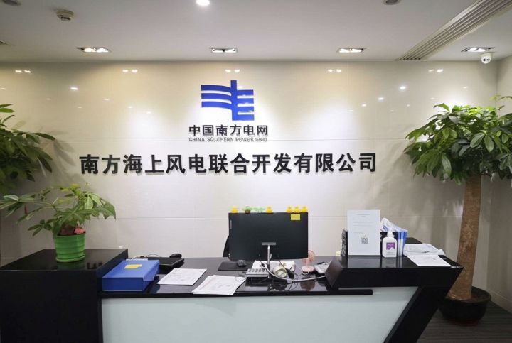
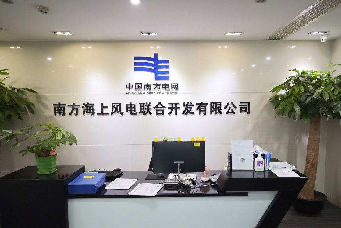
Autonomous drone inspection of offshore wind-turbine blades and towers, with China Southern Power Grid.

  • CSG industry partner
  • Zhuhai joint-lab base
Problem, approach & results

ProblemOffshore wind turbines are far from shore and GNSS-challenged near blades and towers; manual inspection is slow and risky.

Approach
  • Autonomous UAV system for blade and tower inspection of offshore wind turbines
  • Robust positioning and perception near large rotating structures
  • Developed within the Guangdong–Hong Kong Joint Laboratory for Marine Infrastructure
Safety-Certifiable UAV System for Terrain and Civil Infrastructure Inspection

Safety-Certifiable UAV System for Terrain and Civil Infrastructure Inspection

Drones that inspect slopes, forests and structures where GNSS is weak, with certified positioning.

  • US patent filed
Problem, approach & results

ProblemSlopes, forests and civil structures block satellites, yet inspection drones need certified positions to fly safely.

Approach
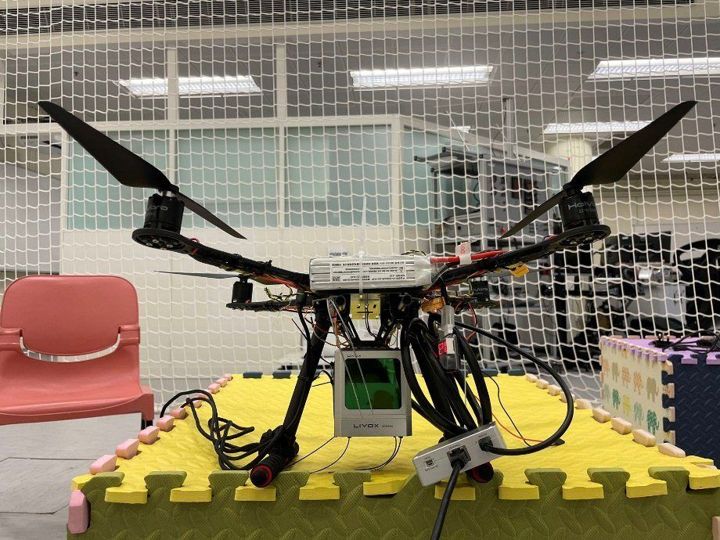
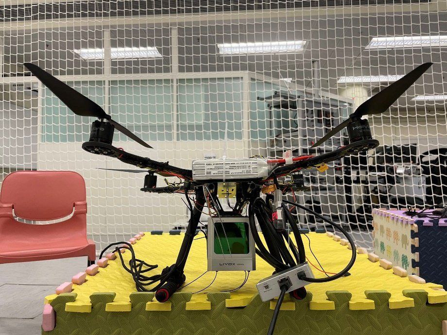
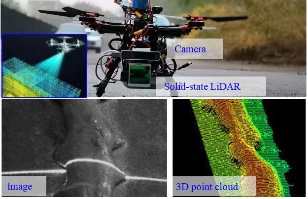
  • Rotary-wing UAV with camera, solid-state LiDAR, multi-frequency GNSS, IMU and onboard computing
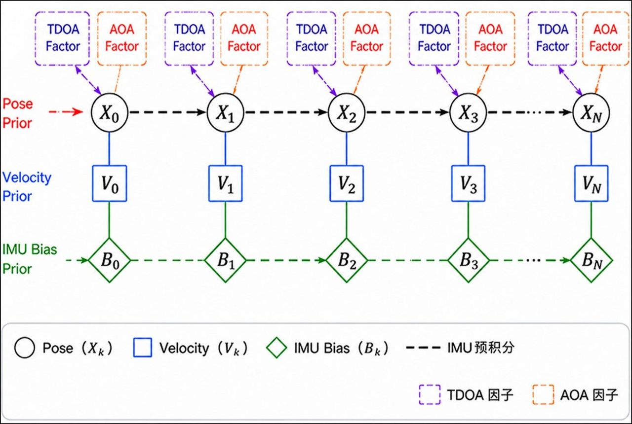
  • LiDAR-aided GNSS with NLOS mitigation and factor-graph pose estimation
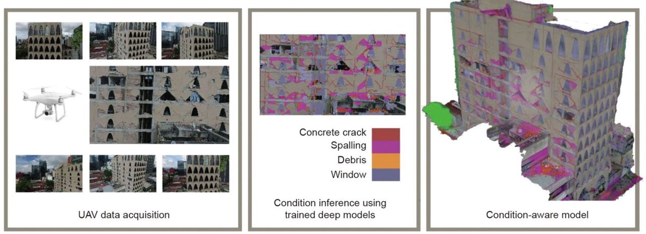
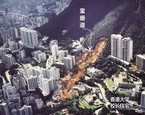
  • Deep-learning detection of landslides, rockfalls and building damage from images and point clouds

ResultsThe positioning work fed the cleaning-drone US patent application.

Large Vision Model for UAV–UGV Map Update

Large Vision Model for UAV–UGV Map Update

Drones and ground robots work together, guided by a large vision model, to keep city maps up to date.

  • UAV + UGV air–ground mapping
Problem, approach & results

ProblemCity maps go out of date quickly; ground robots lose GNSS in street canyons and cannot see the big picture.

Approach
  • Bandwidth-light UAV–UGV feature exchange, with UAV GNSS as the ground robot's reference
  • Factor-graph fusion of LiDAR, camera, IMU and GNSS from air and ground
  • A large vision model detects map changes for update
Safe-assured Learning-based Deep SE(3) Motion Planning and Control for UAVs

Safe-assured Learning-based Deep SE(3) Motion Planning and Control for UAVs

Learning-based joint motion planning and control for agile drones, with safety guarantees.

  • SE(3) joint planning & control
  • Safe learning-based control
Problem, approach & results

ProblemLearned controllers fly aggressively but give no safety guarantee; classical planners are safe but slow and conservative.

Approach
  • Deep networks that plan and control directly on SE(3), position and attitude together
  • Safety filters that keep learned commands inside certified bounds
  • Validation on TAS Lab agile UAVs
Reliable UAV Perception and Perching Solutions in Urban Streets

Reliable UAV Perception and Perching Solutions in Urban Streets

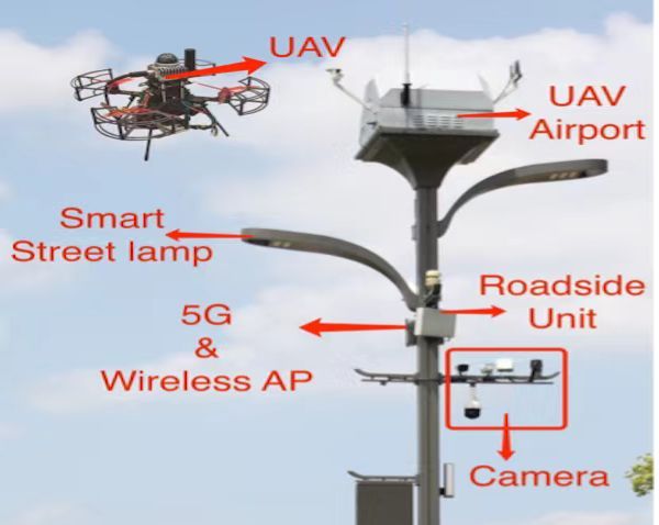
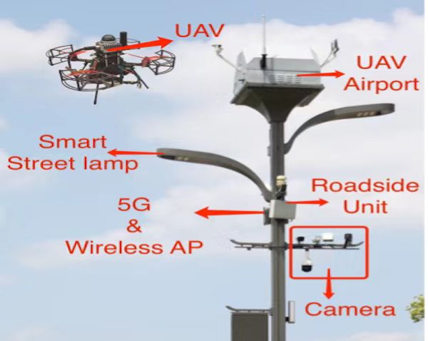
Smart street-light poles with UAV airports: precise landing, wireless charging and battery management for continuous drone operation.

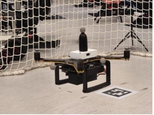
  • AprilTag precision landing
  • Wireless charging on the pole
  • 4G MQTT UAV–airport link
Problem, approach & results

ProblemDrones in cities need somewhere safe to land, recharge and be managed, without a human on site.

Approach
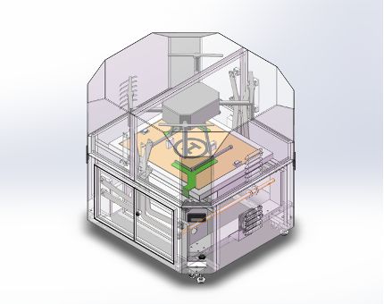
  • UAV airports on smart street-light poles with wireless charging and AprilTag-based precision landing
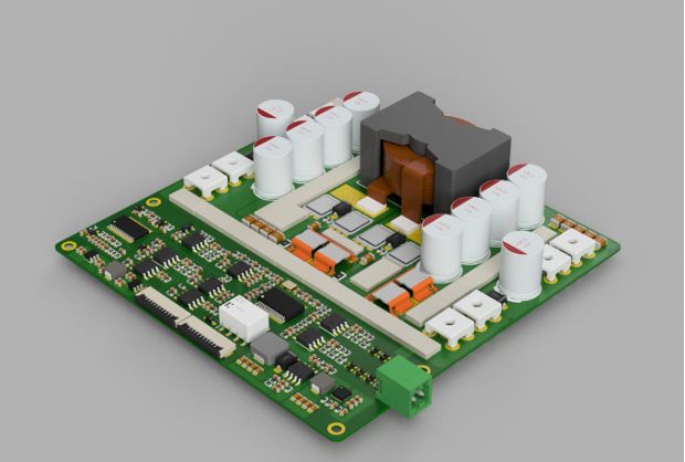
  • Custom power-distribution board for seamless switching between battery and external power
  • GNSS, Vicon and AprilTag localisation fused by an extended Kalman filter; 4G MQTT communication

ResultsExperimental validation of AprilTag localisation, power management and wireless communication under dynamic conditions.

UAV-Aided Additive Manufacturing for CFRTP Composites

UAV-Aided Additive Manufacturing for CFRTP Composites

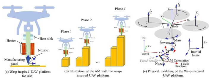
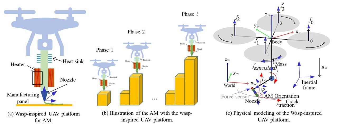
A flying 3D printer: UAV positioning and control for printing carbon-fibre-reinforced thermoplastic composites.

  • CFRTP composite material
  • MPC joint rotor–manipulator control
  • LiDAR quality monitoring
Problem, approach & results

ProblemLarge or high structures cannot be printed by fixed gantries; a drone printer must hold millimetre accuracy while flying.

Approach
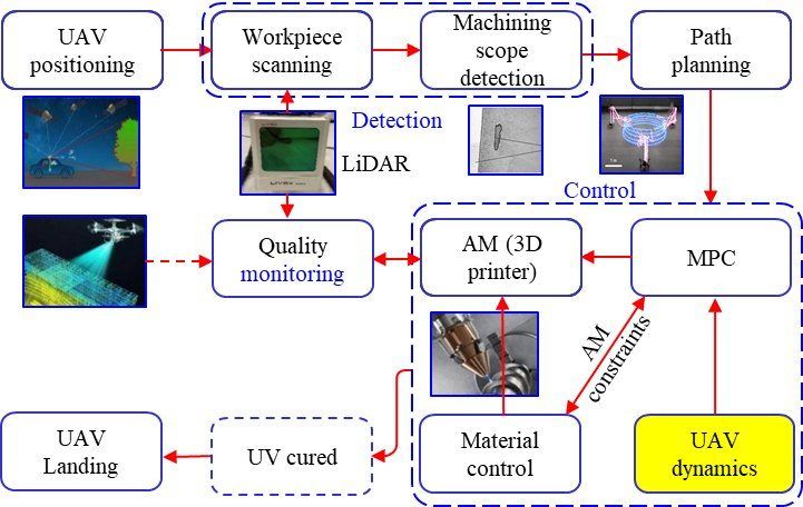
  • Rotary-wing UAV with positioning, LiDAR, a lightweight printer and a nozzle manipulator
  • Joint MPC of rotors and manipulator, with extrusion matched to print speed
  • In-process quality monitoring by solid-state LiDAR scanning

ResultsThe platform links to the lab's UAV inspection and cleaning work.

Video Demonstrations

Intelligent cleaning UAV demonstration, PolyU-Wuxi Research Institute
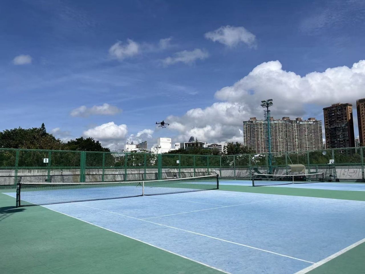
UAV system demonstration, TAS Lab, PolyU

In the Media

RTHK interview
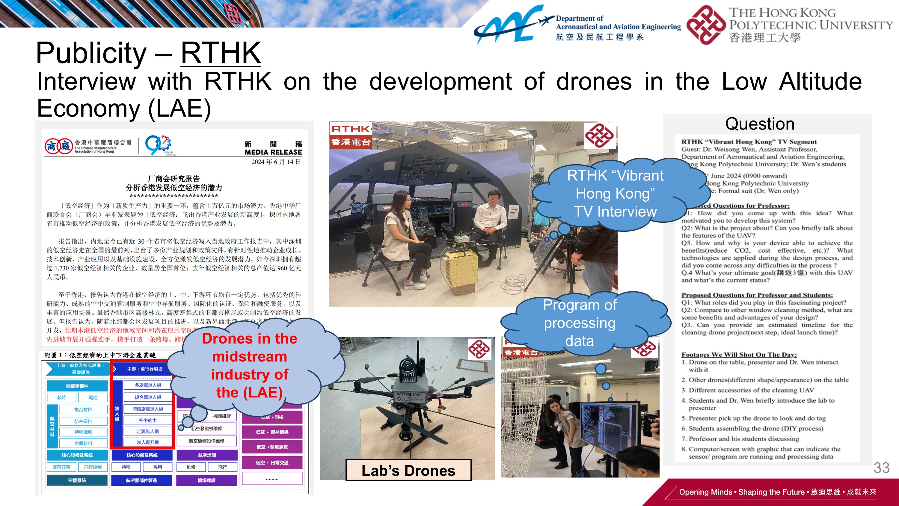
RTHK interview on drone window cleaning and aerial 3D printing (June 2024)
TVB coverage
TVB news on drone façade cleaning (May 2024)
Ming Pao coverage
Ming Pao feature (May 2024); also covered by Headline Daily (July 2024)

Selected Publications

Full publication list →