Research direction

Safety-certifiable Multi-Sensor Fusion

Robot navigation that knows when it can be trusted

The Hong Kong Polytechnic University Department of Aeronautical and Aviation Engineering
← All research directions

Visual and LiDAR SLAM are challenged in complex urban scenes: moving vehicles, repetitive structures and degraded GNSS make errors appear silently. For autonomous systems that must be certified, an accurate answer is not enough — the system also has to bound its own error.

We study how dynamic scenes affect visual, LiDAR and inertial state estimation, make the fusion robust to them, and bring aviation-style integrity monitoring — fault detection, exclusion and protection levels — to robots, cars, aircraft and wearables.

  • GNSS/LiDAR/camera/IMU fusion
  • Integrity monitoring
  • Protection levels
  • Prior-map localisation
  • Inertial deep learning
  • Factor graph optimisation
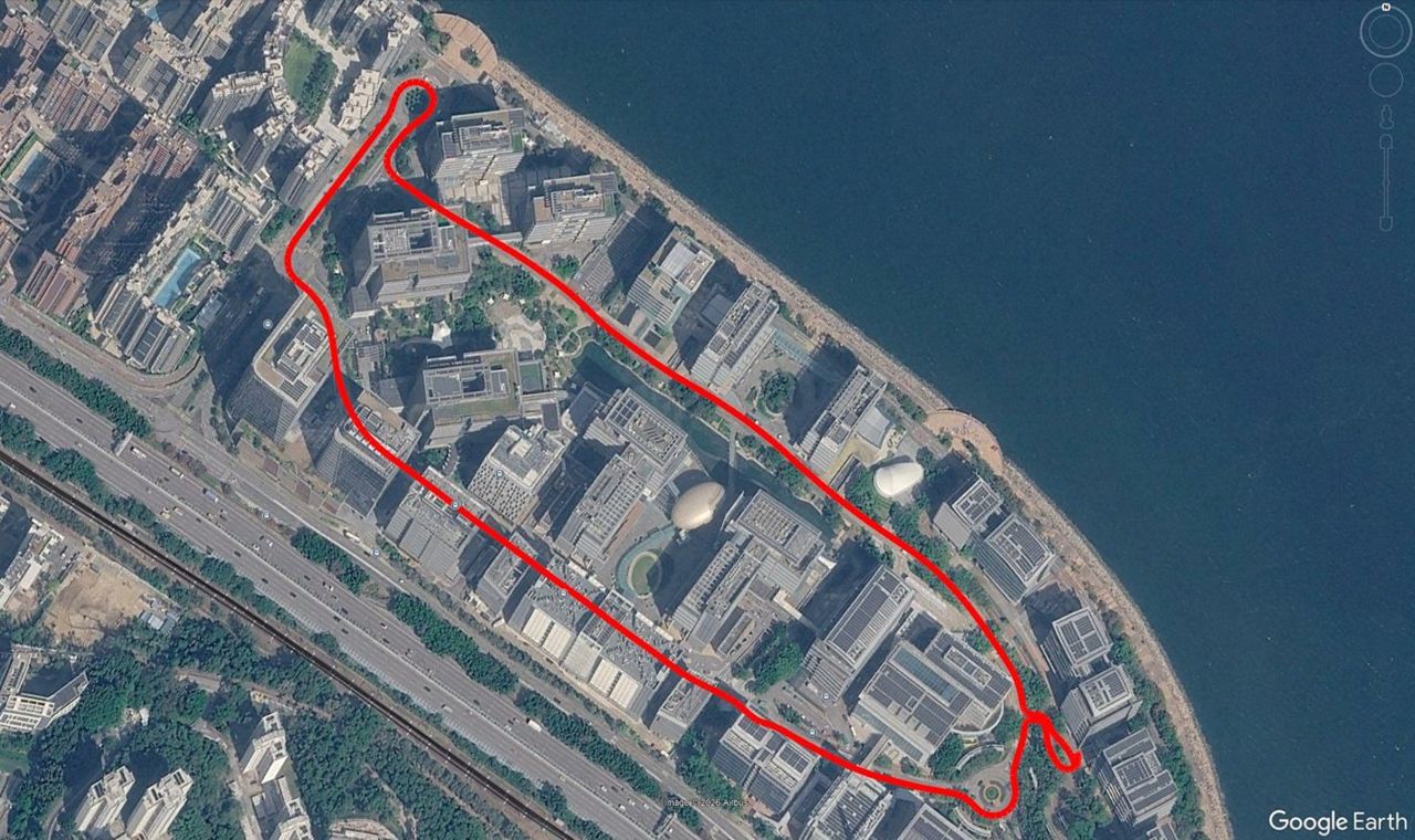
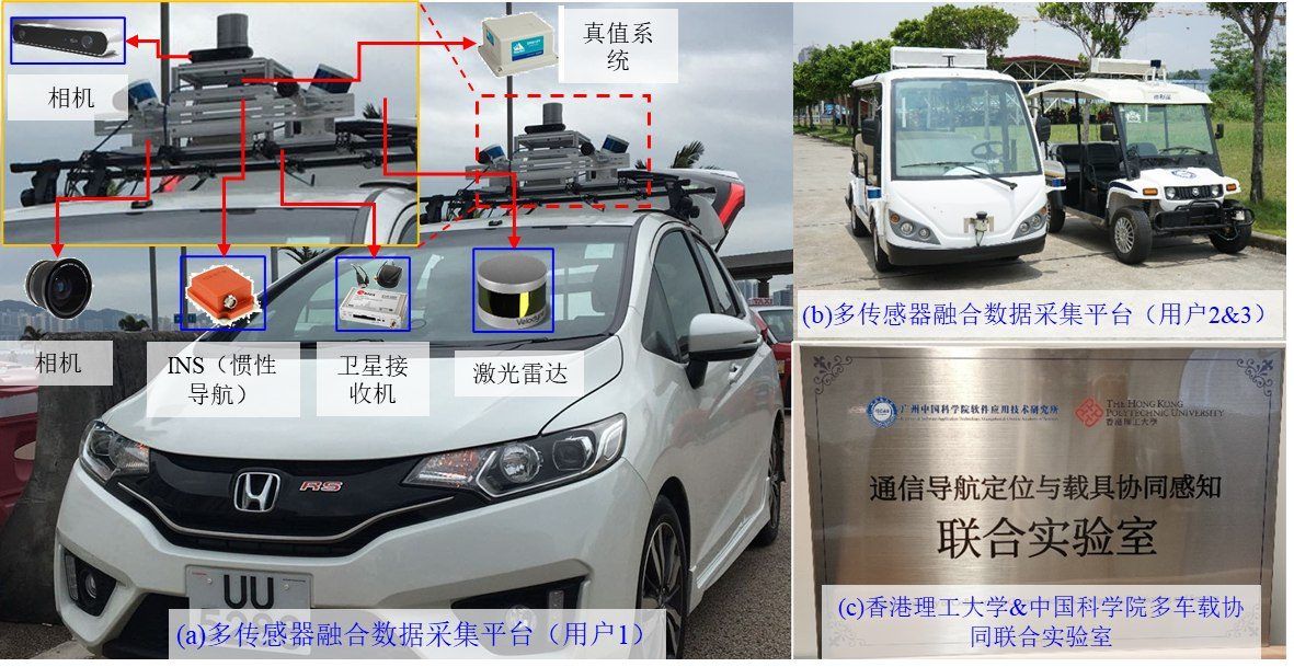
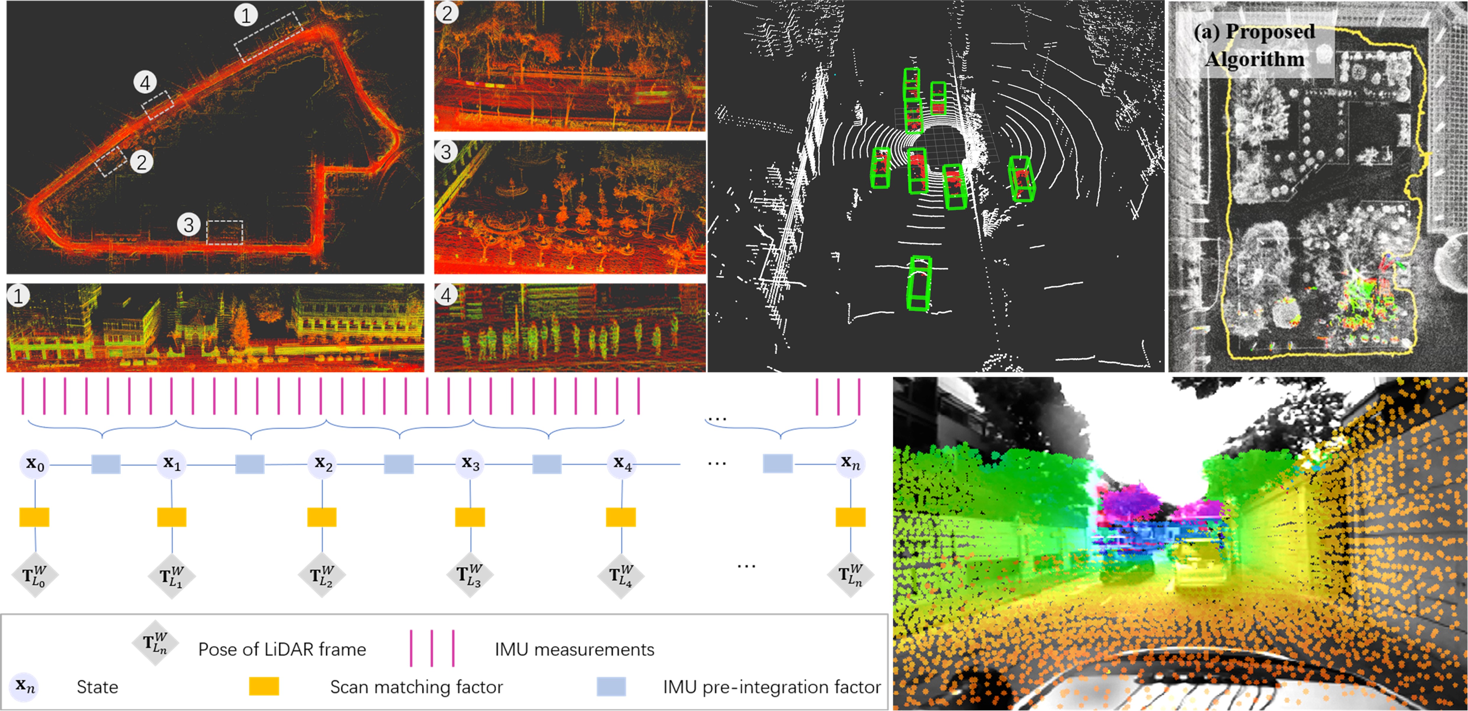
GNSS/LiDAR/visual/inertial integration for robot navigation

Our Approach

  1. Robust fusion in dynamic scenes

    Detect and remove moving objects and outliers so that LiDAR, visual and inertial odometry stay consistent in crowded streets.

  2. Safety-quantifiable localisation

    Line- and plane-feature localisation against 3D prior maps, with a quantified error bound for every pose.

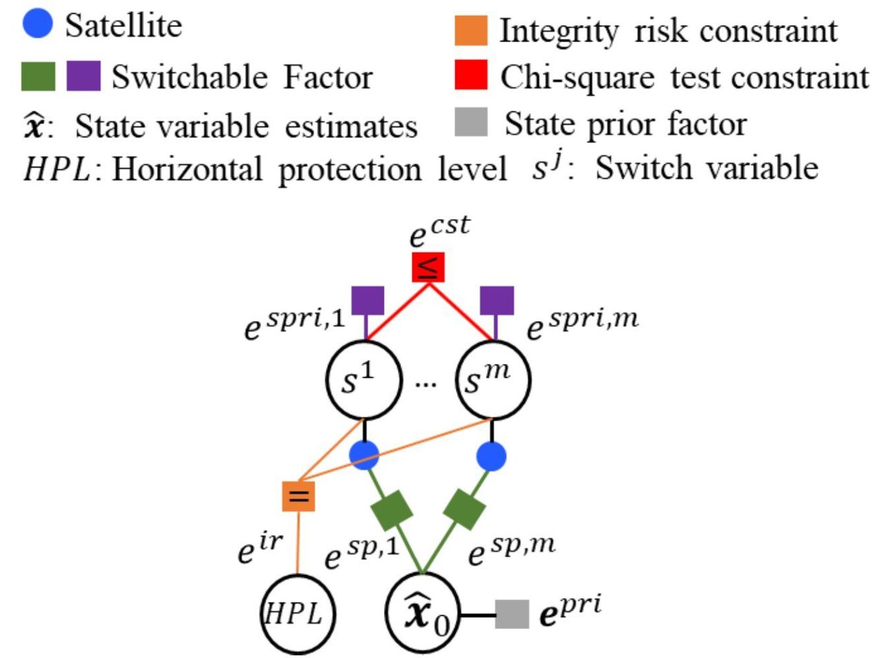
  3. Integrity monitoring for multi-sensor systems

    Fault modes, alert limits and protection levels adapted from aviation ARAIM to urban vehicles, aircraft and wearables.

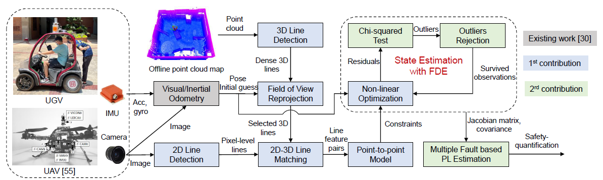
Safety-certifiable visual localisation with a 3D prior map

Research in Action

Systems we have built and tested with partners. Open a card for the problem, our approach, results and photos.

Safety-Certified Multi-Source Fusion Positioning for Autonomous Vehicles

Safety-Certified Multi-Source Fusion Positioning for Autonomous Vehicles

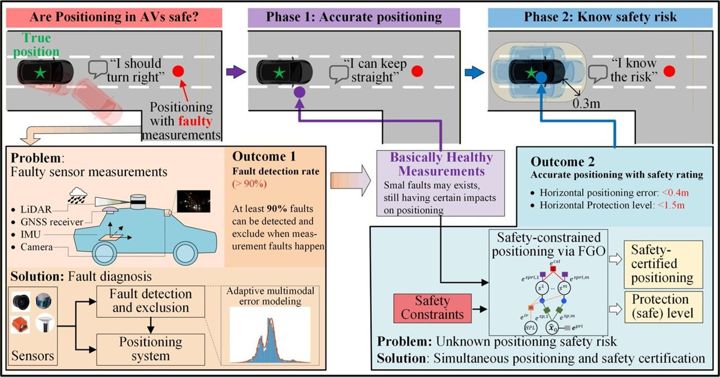
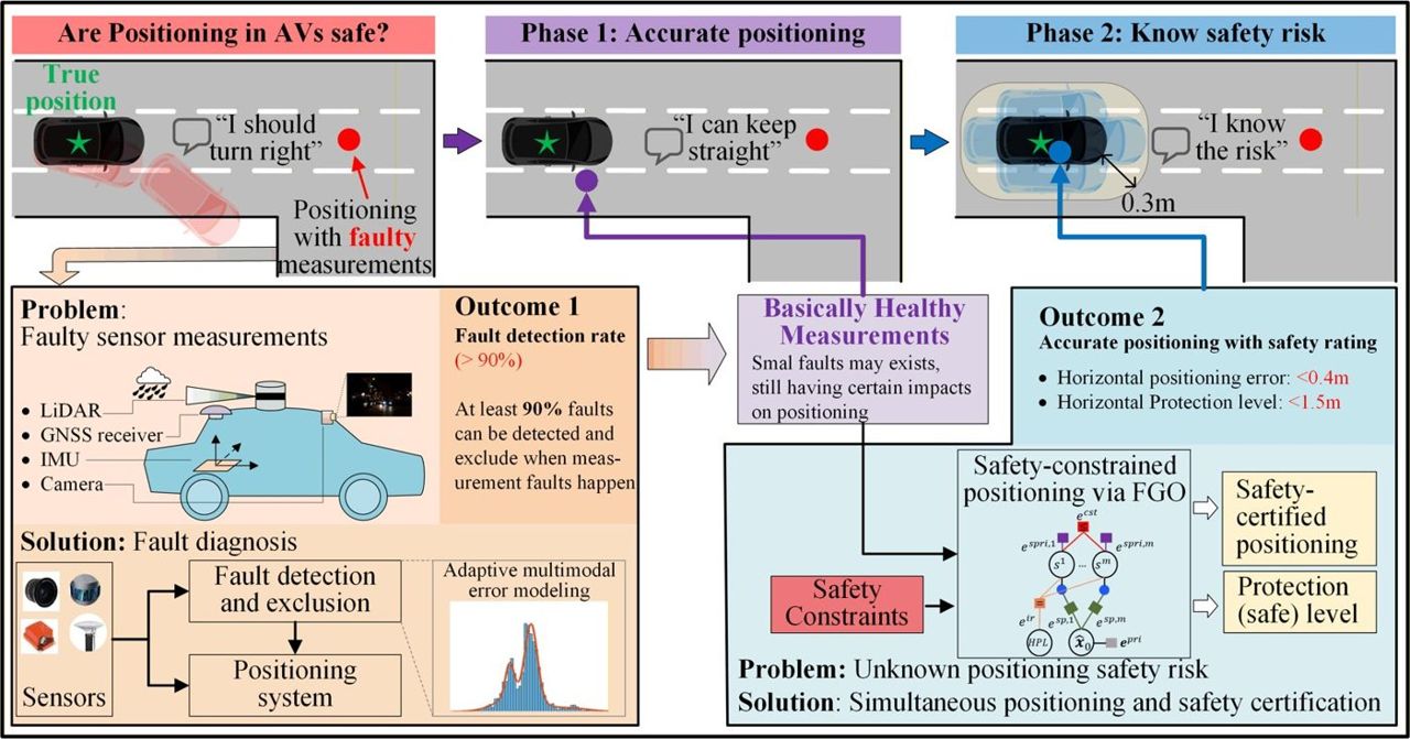
Integrity monitoring brought from aviation into urban autonomous-vehicle positioning.

  • ARAIM integrity method
Problem, approach & results

ProblemAV positioning in cities fails silently: sensors degrade together and no alert limit tells the planner when to stop trusting it.

Approach
  • Urban alert limits derived from lane geometry and vehicle size
  • Fault modes catalogued for GNSS, LiDAR and camera in urban scenes
  • ARAIM-style fault detection, exclusion and protection levels for multi-sensor fusion

ResultsOperational and safety-requirement report, system design and final test report.
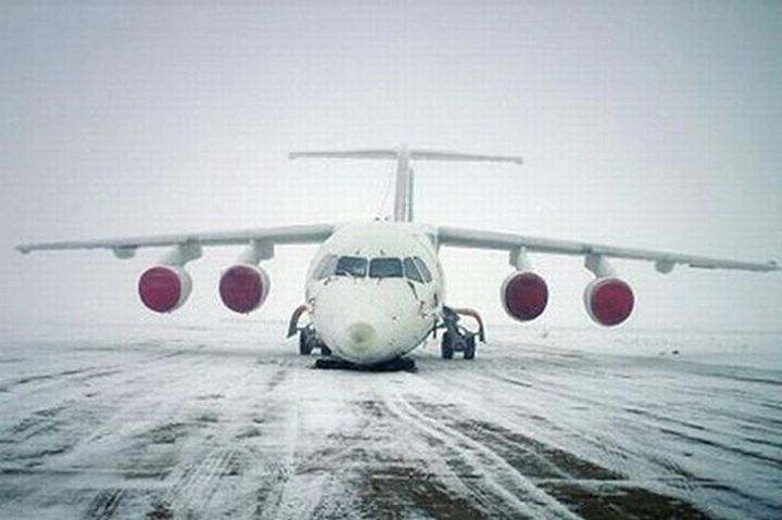
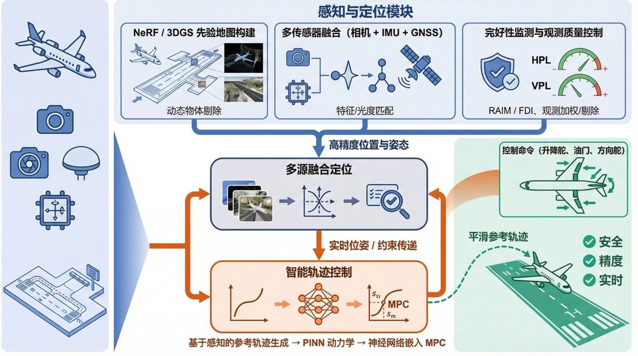
Autonomous Take-off/Landing and Obstacle Avoidance for Civil Aircraft

Autonomous Take-off/Landing and Obstacle Avoidance for Civil Aircraft

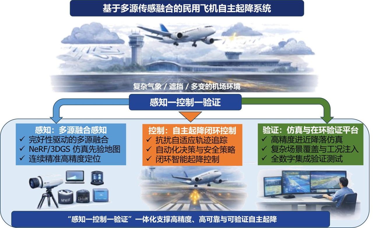
Multi-source fusion for safety-critical take-off, landing and obstacle avoidance of civil aircraft.

  • ±0.3 m runway-centreline target
  • 10 test scenarios
  • TRL 4→5 technology-readiness target
Problem, approach & results

ProblemInstrument landing depends on ground signals, single sensors can be jammed or spoofed, and vision degrades at night, in haze and in glare.

Approach
  • Multispectral vision (visible, infrared, event camera) fused with IMU and GNSS
  • Visual-inertial navigation with RAIM-style integrity checks and robust MPC control
  • Digital-twin test bench with 10 scenarios: night, haze, GPS failure, wind gusts and joint faults

ResultsMultispectral perception and VIO prototype, robust MPC module, digital-twin platform and a TRL-5 validation report.

AI-Assisted Inertial Navigation System

AI-Assisted Inertial Navigation System

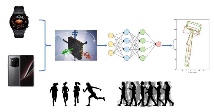
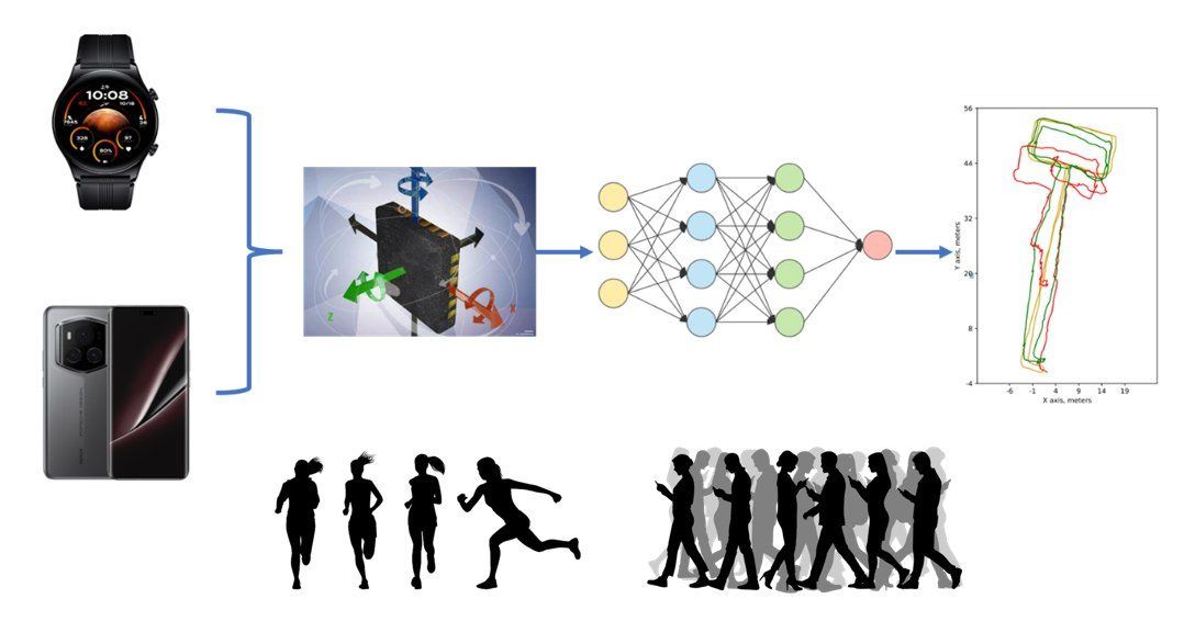
Deep-learning inertial odometry for phones and wearables, now deployed on consumer devices.

  • 60K+ devices deployed
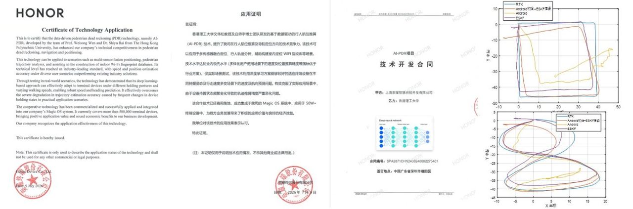
  • Certified technology application
Problem, approach & results

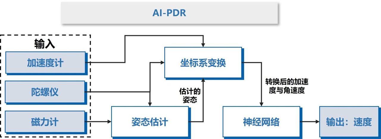
ProblemPhones and wearables must keep tracking users where GNSS is weak, using only noisy IMU and magnetometer data.

Approach
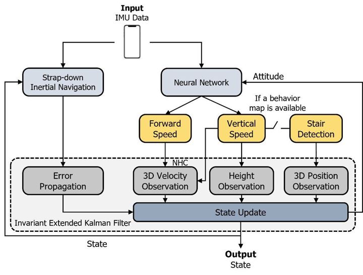
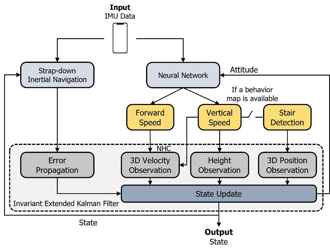
  • Deep-learning inertial odometry from accelerometer, gyroscope and magnetometer
  • Trajectory output with confidence for downstream fusion
  • Adaptive error-state Kalman filter for wearable attitude

ResultsCertificate of technology application from the partner.

Maximum Consensus Integration of GNSS and LiDAR for Urban Navigation

Maximum Consensus Integration of GNSS and LiDAR for Urban Navigation

Outlier-robust urban navigation with Leibniz University Hannover: keep only the GNSS and LiDAR measurements that agree with each other.

  • 2 universities
  • Exchange visits both ways
  • Robust outlier rejection
Problem, approach & results

ProblemGNSS and LiDAR measurements in cities contain many outliers that break least-squares and Kalman estimators.

Approach
  • Maximum-consensus estimation that keeps only mutually consistent measurements
  • Joint GNSS–LiDAR formulation for urban vehicles
  • Student and staff exchange between Hong Kong and Hannover

ResultsBuilt a lasting research link with Leibniz University Hannover.

Video Demonstrations

Safety-quantifiable line-feature monocular visual localisation with a 3D prior map
Multi-sensor integrated navigation system for autonomous driving
Low-cost solid-state LiDAR/inertial localisation with a prior map
ION GNSS+ 2021 talk: coarse-to-fine LiDAR SLAM with dynamic object removal

Selected Publications

2025

2024

2023

2018–2022

Full publication list →