Research direction

3D LiDAR Aided GNSS Positioning

AI-driven satellite positioning that stays accurate in dense urban canyons

The Hong Kong Polytechnic University Department of Aeronautical and Aviation Engineering
← All research directions

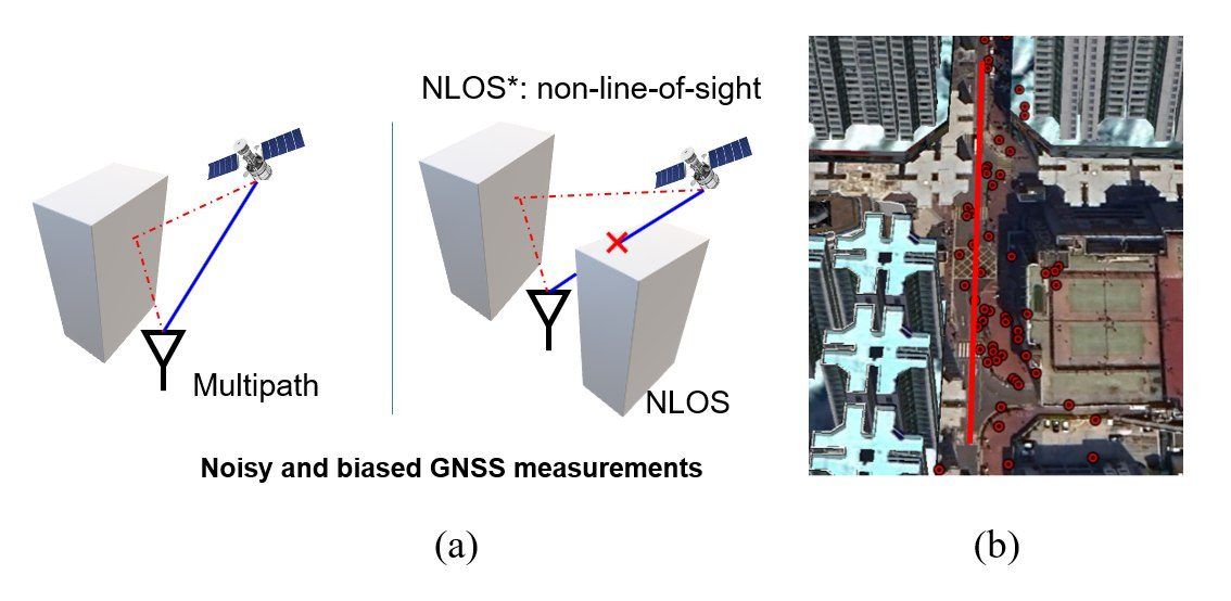
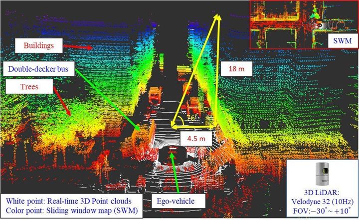
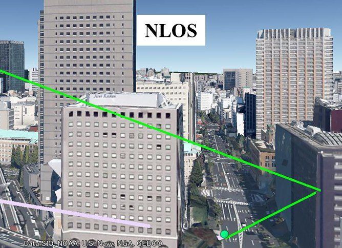
Satellite positioning works well in open sky but breaks down in cities such as Hong Kong, where tall buildings and double-decker buses block and reflect the signals. These non-line-of-sight (NLOS) receptions and multipath are the main difficulty in using GNSS for intelligent vehicles, drones and robots.

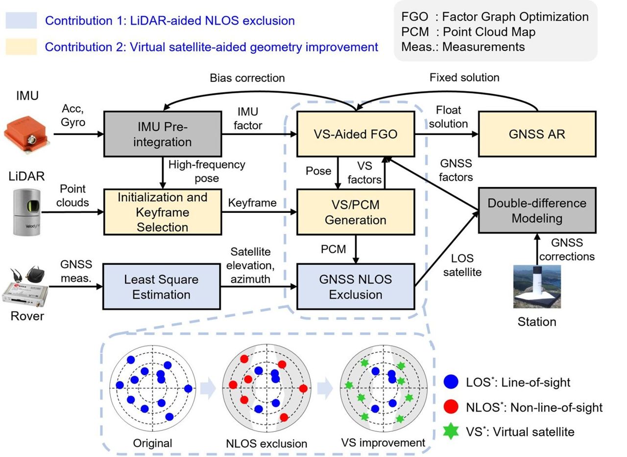
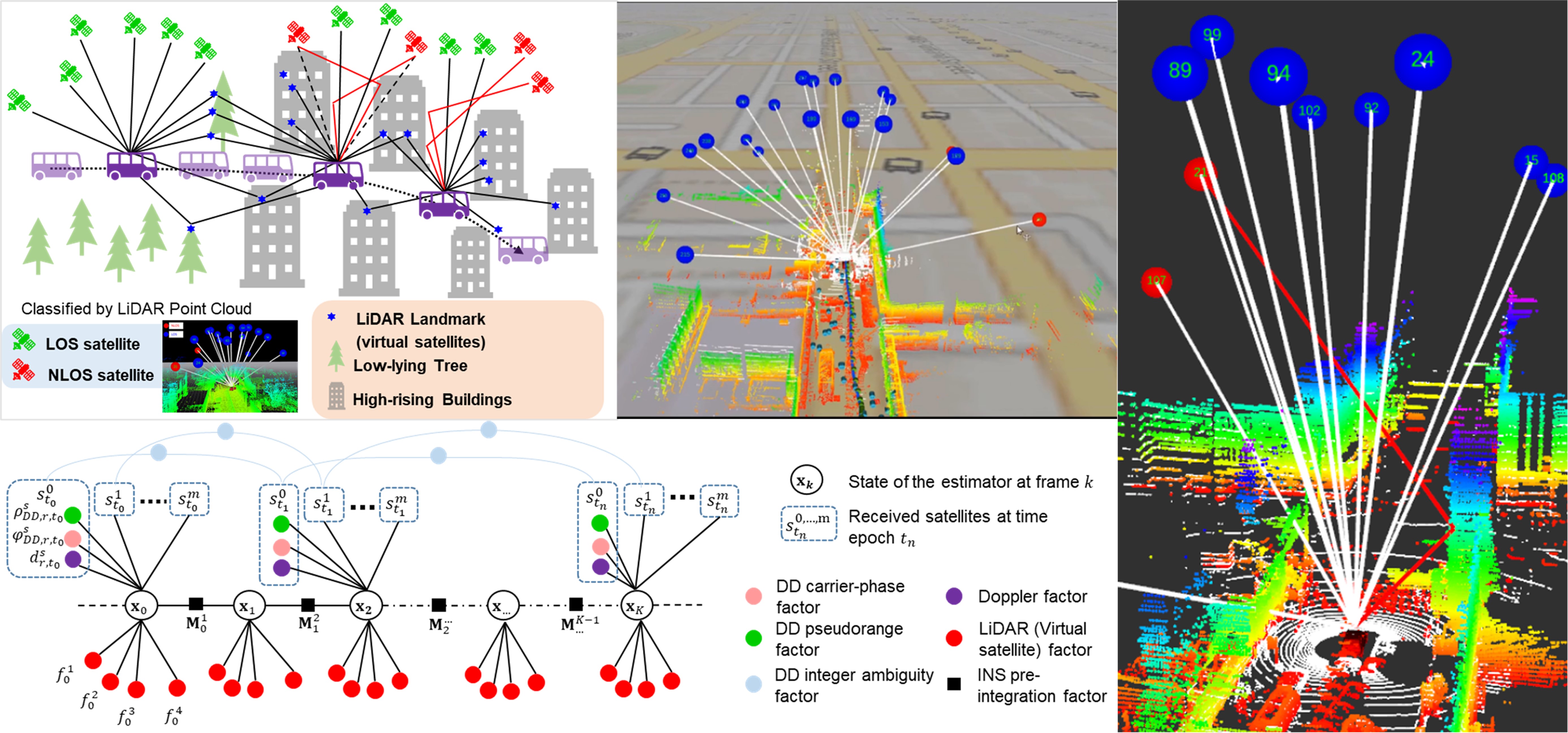
We let the robot’s own perception — 3D LiDAR, cameras and learned models — reveal which satellites are blocked or reflected, and then correct or exclude them inside robust factor-graph estimators. The work began with LiDAR-aided NLOS exclusion, which won a Best Presentation Award at ION GNSS+ 2020 (selected by session chairs from Waymo and Swift Navigation), and now extends to GNSS-RTK, PPP-RTK, 5G and LEO satellites.

  • NLOS & multipath modelling
  • 3D LiDAR aided GNSS
  • GNSS-RTK & PPP-RTK
  • Factor graph optimisation
  • Deep learning for GNSS
  • Open datasets & code
3D LiDAR aided GNSS positioning for urban robot navigation

Our Approach

  1. Perceive the signal environment

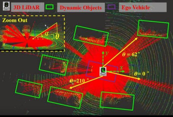
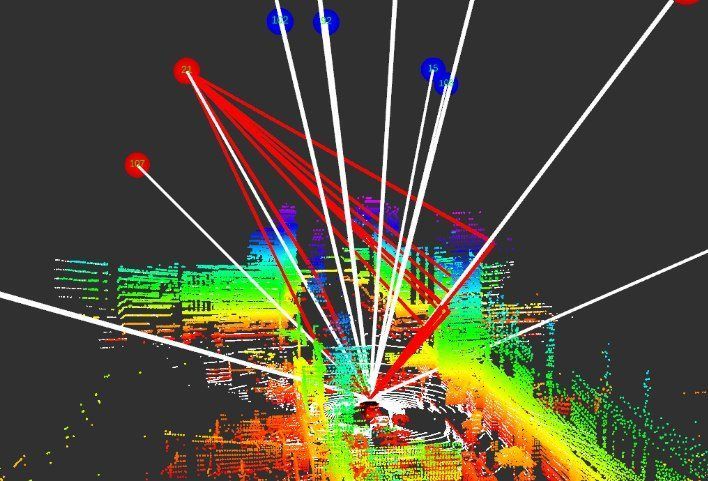
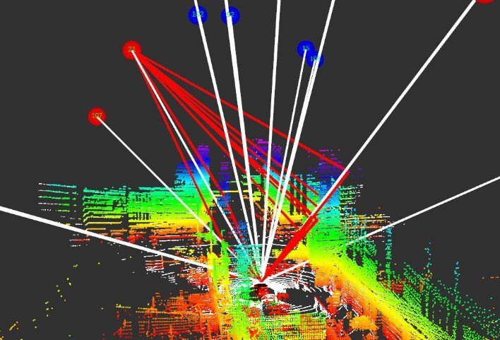
    Real-time 3D LiDAR and camera perception identifies the buildings and vehicles that block or reflect each satellite signal.

  2. Model and correct NLOS and multipath

    Physical and learned models correct biased pseudoranges or exclude them, from single-point positioning to RTK.

  3. Improve satellite geometry

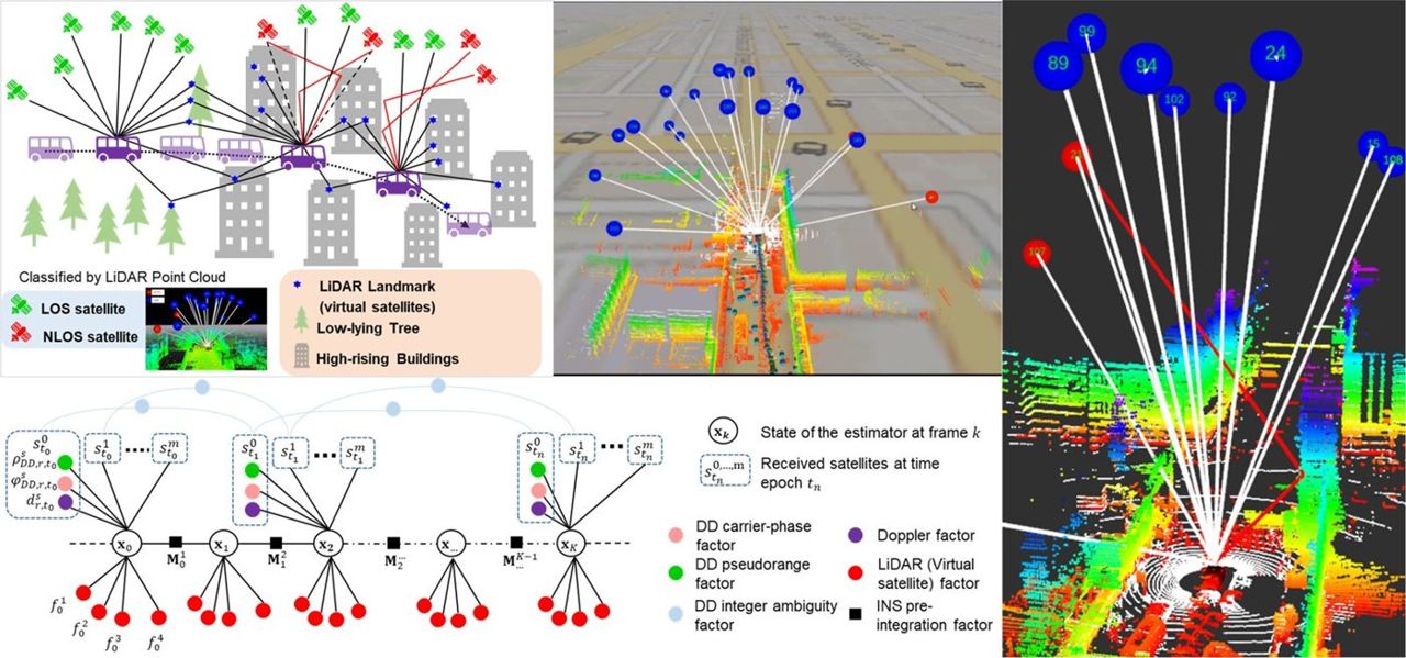
    LiDAR landmarks act as 'virtual satellites', and 5G and LEO signals add constraints where blocked satellites leave poor geometry.

  4. Robust estimation with factor graphs

    Robust losses, multi-epoch ambiguity resolution and integrity constraints keep the solution reliable in deep canyons.

Research in Action

Systems we have built and tested with partners. Open a card for the problem, our approach, results and photos.

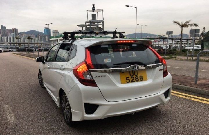
LiDAR-Aided GNSS NLOS Modelling

LiDAR-Aided GNSS NLOS Modelling

Modelling and mitigating multipath and NLOS signals with 3D LiDAR for urban robots.

  • 12–20% accuracy gain
  • KLT open NLOS dataset
Problem, approach & results

ProblemReflected and blocked GNSS signals cause metre-level errors in cities, and existing models ignore the real 3D surroundings.

Approach
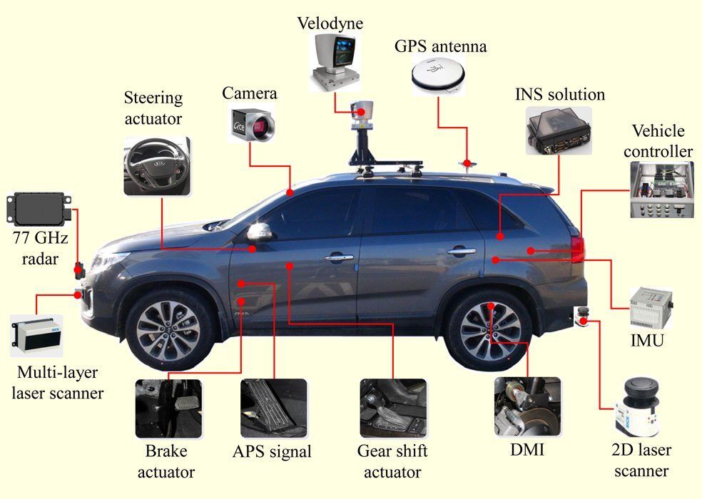
  • Real-time LiDAR perception of buildings and vehicles that block or reflect signals
  • Physical NLOS/multipath models driven by the LiDAR scene
  • Correction or exclusion inside GNSS/INS factor graphs
3D LiDAR-Aided GNSS Positioning in Urban Canyons
3D LiDAR-Aided GNSS Positioning in Urban Canyons

3D LiDAR used to detect and correct NLOS satellites so that GNSS-RTK keeps its fix in urban canyons.

  • GLIO IEEE T-IV 2023
  • RTK higher fix rate
Problem, approach & results

ProblemGNSS-RTK loses its fixed solution in urban canyons because NLOS satellites are not detected.

Approach
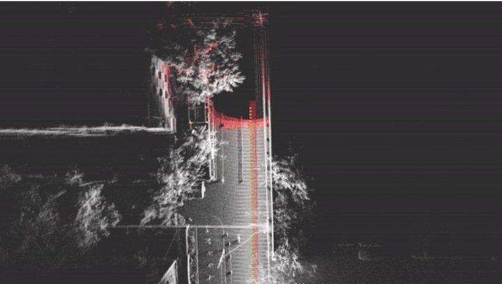
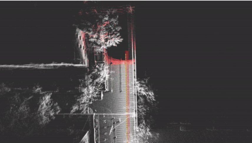
  • 3D LiDAR point clouds detect buildings that block satellites
  • NLOS exclusion and correction before RTK
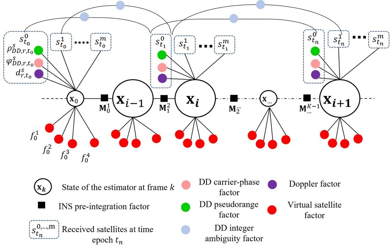
  • Factor-graph integration of GNSS, LiDAR and IMU

ResultsGLIO and dynamic-object-aware LiDAR odometry (IEEE T-IV); geospatial factor-graph positioning (IEEE TIM).

Lane-Level Localization with Raw GNSS, LiDAR and IMU

Lane-Level Localization with Raw GNSS, LiDAR and IMU

Raw GNSS, LiDAR and IMU tightly fused for lane-level positioning in urban canyons, with Huawei.

  • TechConnect innovation award 2021
  • T-ITS NLOS paper 2022
  • US patent 12,123,961 granted
Problem, approach & results

ProblemGNSS-RTK fixes are lost in urban canyons, and LiDAR odometry drifts among moving objects without a prior map.

Approach
  • Raw GNSS, LiDAR and IMU tightly coupled in one optimisation
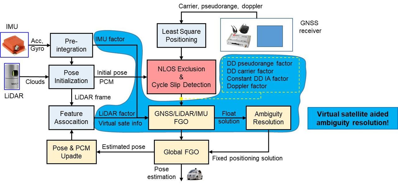
  • 3D-LiDAR-based NLOS exclusion and cycle-slip detection
  • LiDAR landmarks used as “virtual satellites” to raise the RTK fix rate

ResultsPapers in IEEE T-ITS, Journal of Geodesy, IET ITS, ITSC 2022 and ION GNSS+ 2021; US patent 12,123,961 on 3D LiDAR-aided GNSS.

Vision-Aided GNSS-RTK Positioning for UAVs in Urban Canyons

Vision-Aided GNSS-RTK Positioning for UAVs in Urban Canyons

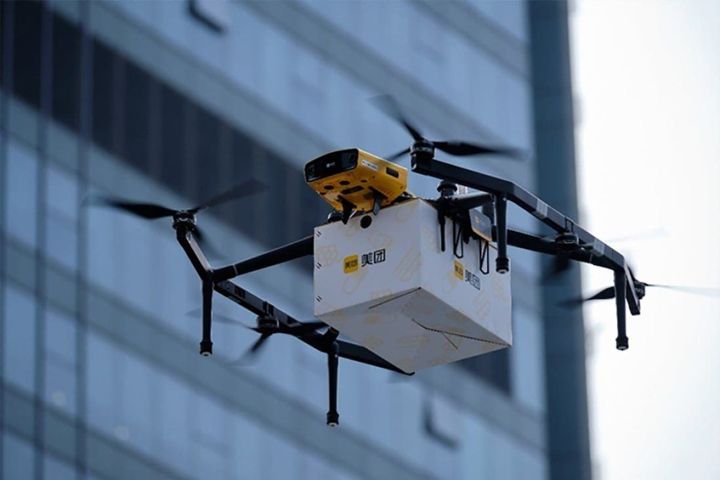
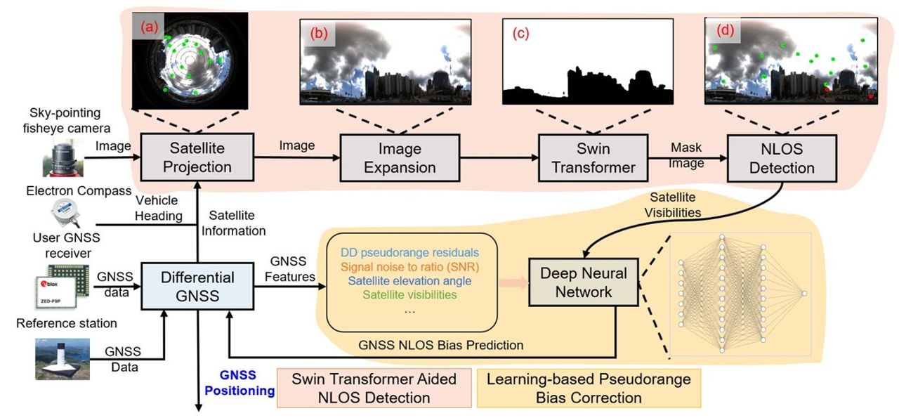
Sky-view NLOS detection with a fisheye camera so delivery drones keep RTK-level positioning in deep street canyons.

  • >99% NLOS detection accuracy
  • ITSC 2023 paper
Problem, approach & results

ProblemDrone delivery needs RTK-level positions, but reflected signals in deep canyons stop RTK from fixing.

Approach
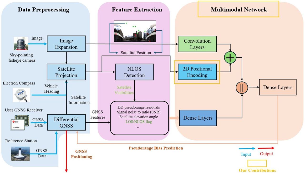
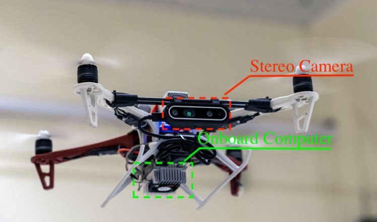
  • Fisheye sky segmentation (Swin Transformer) flags NLOS satellites
  • Learned pseudorange-bias correction tightly coupled with GNSS
  • RTK ambiguity resolution with NLOS exclusion

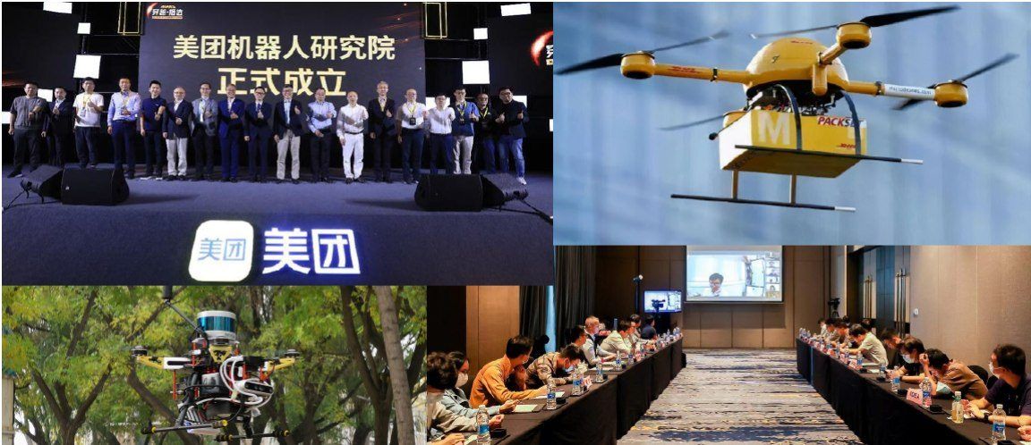
ResultsMarsTalk 2025 industry salon with Meituan at PolyU and a PolyU–Meituan press release.

GNSS/5G Integrated Positioning for UAVs

GNSS/5G Integrated Positioning for UAVs

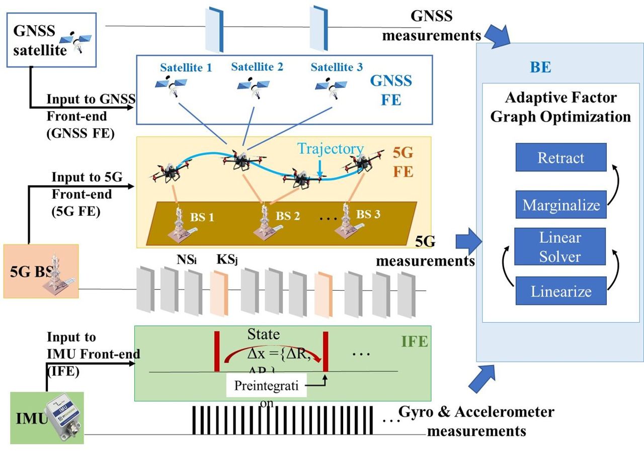
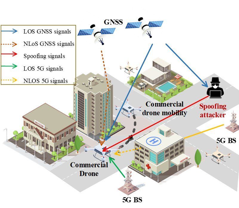
GNSS and 5G fused with quantified integrity so that drones can fly safely through complex urban scenes.

  • Safety certifiable positioning output
Problem, approach & results

ProblemUrban UAV routes pass through deep street canyons where GNSS alone is biased by NLOS signals and gives no safety bound.

Approach
  • NLOS-aware GNSS positioning aided by 5G ranging, IMU, LiDAR and cameras
  • Protection levels that certify when the position can be trusted for navigation
  • Requirement analysis, algorithm design and flight validation in Hong Kong scenes
Data-Driven-Assisted GNSS RTK/INS Navigation in Urban Canyons

Data-Driven-Assisted GNSS RTK/INS Navigation in Urban Canyons

Deep networks that clean raw GNSS and IMU data for RTK/INS navigation.

  • 12–20% accuracy gain
  • 0.5 s per epoch on Jetson
Problem, approach & results

ProblemUrban GNSS errors are strongly correlated in time and space, which hand-made models cannot capture.

Approach
  • Deep networks that detect and mitigate GNSS outliers
  • Spatio-temporal IMU noise model
  • Multi-epoch features to detect wrong RTK fixes

ResultsPreliminary results attracted the Meituan UAV collaboration; featured by InsideGNSS on AI for GNSS.

GNSS/IMU/Camera Factor-Graph Vehicle Positioning in Urban Environments

GNSS/IMU/Camera Factor-Graph Vehicle Positioning in Urban Environments

Multi-epoch ambiguity resolution in a factor graph for lane-level in-car navigation.

  • ≈5% extra accuracy gain
  • ION GNSS+ 2024 paper
Problem, approach & results

ProblemCar navigation apps need lane-level accuracy in cities, but single-epoch GNSS cannot resolve carrier-phase ambiguities there.

Approach
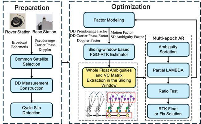
  • Factor-graph optimisation of GNSS, IMU and camera over a sliding window
  • Multi-epoch carrier-phase ambiguity resolution
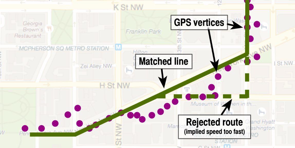
  • Robust weighting against outliers and map-matching checks

ResultsION webinar “FGO for GNSS/INS integration” and an ION GNSS+ 2024 paper.

Perception-based PPP-RTK/LVINS

Perception-based PPP-RTK/LVINS

Perception-aided precise positioning: PPP-RTK fused with LiDAR-visual-inertial navigation.

  • PPP-RTK + LVINS
Problem, approach & results

ProblemPPP-RTK gives centimetre accuracy in open sky but collapses in cities, where vision and LiDAR could help.

Approach
  • PPP-RTK corrections fused with LiDAR-visual-inertial navigation (LVINS)
  • Perception used to detect NLOS satellites and keep ambiguities fixed
  • Tests on ground vehicles and UAVs with Hong Kong and Tokyo datasets
Resilient GNSS Positioning for UAVs

Resilient GNSS Positioning for UAVs

Robust factor-graph GNSS positioning for UAVs, the foundation of the lab's urban-positioning research.

  • FGO-GNC robust estimator
  • GMM noise model
Problem, approach & results

ProblemUAVs in cities face non-Gaussian GNSS outliers, so standard estimators break where positioning matters most.

Approach
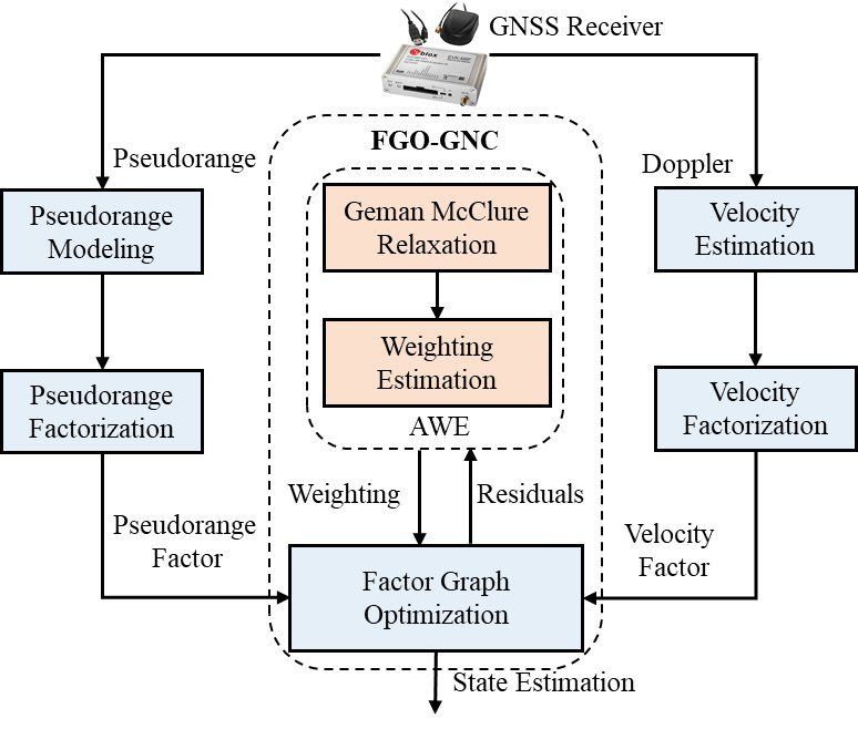
  • Factor-graph GNSS positioning with pseudorange and Doppler over time
  • Adaptive weighting with a Geman–McClure loss solved by graduated non-convexity (FGO-GNC)
  • Gaussian-mixture noise models and integration with 3D LiDAR

ResultsThe methods underpin the lab's later urban-positioning work with Huawei, Meituan and Tencent.

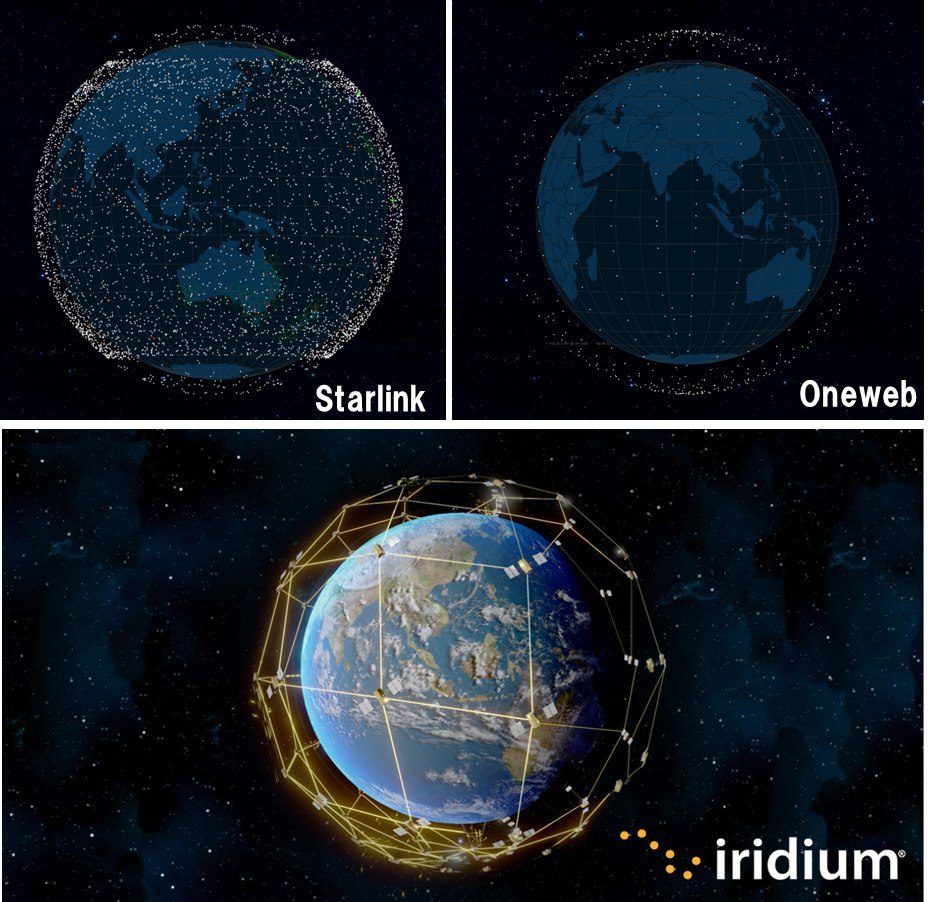
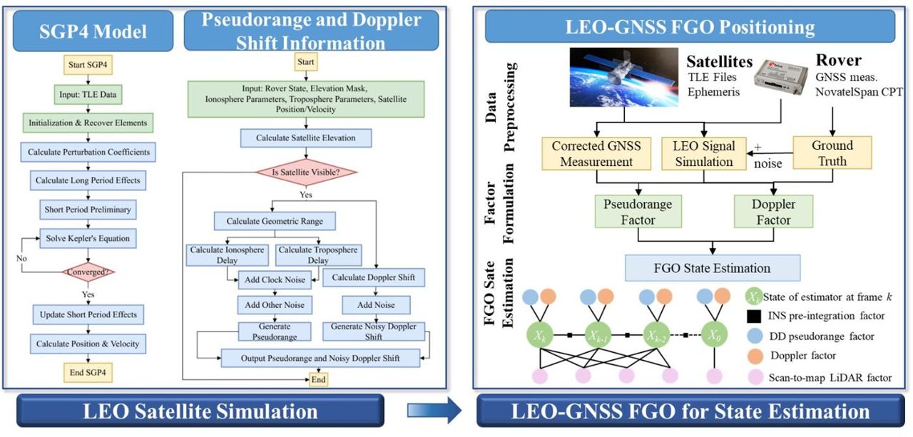
LEO-Satellite V2X and Connected Autonomous Vehicles Survey

LEO-Satellite V2X and Connected Autonomous Vehicles Survey

A survey and theoretical model of Starlink-class LEO satellites for urban vehicle positioning.

  • FGO best accuracy
  • Starlink TLE-based model
Problem, approach & results

ProblemGNSS alone cannot give connected vehicles reliable positions in Hong Kong's canyons; LEO constellations add many fast-moving signals.

Approach
  • Survey of LEO-satellite-enabled V2X and CAV systems and key index criteria
  • Simulated Starlink measurements from TLE files fused with real GNSS data in Whampoa
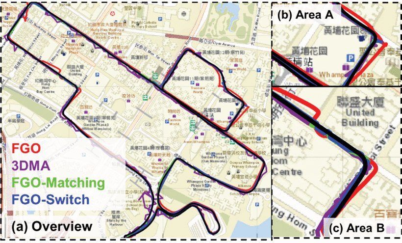
  • Comparison of GNSS-only, GNSS+LEO and factor-graph (GNSS+LEO) positioning

Video Demonstrations

3D LiDAR aided NLOS exclusion for GNSS-RTK positioning in urban canyons
3D LiDAR aided NLOS exclusion for GNSS single-point positioning
ION GNSS+ 2021 talk: 3D LiDAR aided NLOS exclusion for GNSS-RTK
ION GNSS+ 2020 talk: 3D LiDAR aided GNSS and its tight integration with INS
ION GNSS+ 2021 talk: continuous GNSS-RTK aided by LiDAR/inertial odometry

Recognition & Media

Selected Publications

2025

2024

2023

2021–2022

2018–2020

Full publication list →